








A Submerged Mystery
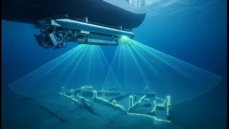
Recent underwater surveys conducted off the coast of Tamil Nadu have identified a series of intriguing structures resting on the seabed. Using advanced sonar equipment, researchers have mapped what appear to be man-made formations, including walls and
potential building complexes, reigniting discussions about the region's legendary lost cities. These explorations, particularly focused around historical sites like Poompuhar and Mahabalipuram, are part of a renewed push by Indian archaeological bodies to investigate the country's vast submerged heritage. While analysis is in its early stages, the sonar images show distinct structural anomalies that stand out from the natural geology of the ocean floor, prompting widespread excitement among historians and archaeologists.
The High-Tech Hunt
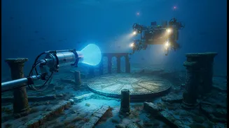
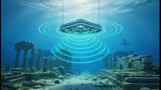
This discovery was made possible by a suite of sophisticated marine exploration instruments. The key technology is side-scan sonar, which is often towed behind a survey vessel in a device called a 'towfish'. It emits acoustic pulses that fan out to create high-resolution images of the seafloor, much like taking a detailed photograph of the ocean bottom. This non-invasive method allows archaeologists to locate and map submerged sites without disturbing them. In addition to sonar, teams are using Remotely Operated Vehicles (ROVs). These unmanned underwater robots, equipped with high-definition cameras, provide a crucial visual inspection of the sonar targets, helping researchers distinguish between natural rock formations and man-made structures. This combination of sonar for broad mapping and ROVs for close-up investigation has become the gold standard in modern underwater archaeology.
Echoes of Poompuhar and the Pallavas
The Tamil Nadu coast is rich with history and lore, making it a prime location for such discoveries. The ancient port city of Poompuhar, also known as Kaveripoompattinam, was a bustling trade hub during the Sangam era and is extensively described in epics like 'Silappatikaram'. Legend and geological evidence suggest large parts of it were submerged by the sea. Similarly, the area off Mahabalipuram, a UNESCO World Heritage site famous for its Pallava-dynasty shore temples, is believed to hold the secrets of six other temples now lost to the waves. Previous explorations in both areas, some dating back decades, had already uncovered tantalizing clues, including brick structures, ring wells, and carved stone blocks. The latest surveys build upon this foundational work, using more advanced technology to create a clearer picture.
From Sonar Pings to Solid Proof
While the sonar maps are promising, the journey from detecting an anomaly to confirming an archaeological site is a long one. The next critical phase involves physical verification. Teams from the Tamil Nadu State Department of Archaeology (TNSDA) and the Archaeological Survey of India's (ASI) Underwater Archaeology Wing will analyse the data to pinpoint the most promising locations. This will be followed by diving expeditions where archaeologists can examine the structures firsthand. A major challenge is that the remains are often covered in thick marine growth and damaged by centuries of strong underwater currents, making identification difficult. Experts will carefully document the sites, look for datable artefacts, and try to determine if the structures are indeed the lost remnants of ancient ports and temples.