


A Deficit of Historic Proportions
The numbers are stark. Across the country, the month of June, which typically marks the grand arrival of the Southwest Monsoon, ended with a significant rainfall deficit. According to the India Meteorological Department (IMD), some regions experienced
their driest June in over a century, with the national average rainfall hovering significantly below the long-period average. States like Kerala, which usually welcome the first monsoon showers, saw deficits of over 60%. Bihar and Jharkhand were similarly parched. This wasn't just a slightly delayed start; it was a meteorological anomaly that effectively pressed pause on the nation's most critical weather system, leaving vast swathes of land waiting desperately for rain.
The Cyclone Culprit
So, what went wrong? Meteorologists point to a primary culprit: Cyclone Biparjoy. While the powerful cyclone churned in the Arabian Sea, it played a disruptive role. Think of the monsoon as a massive, moisture-laden system trying to move inland from the sea. Biparjoy acted like a giant atmospheric vacuum, sucking moisture and energy away from the monsoon's developing current. This diversion of power severely weakened the monsoon's cross-equatorial flow, stalling its advance over the Indian peninsula for a critical period. Instead of progressing steadily northward and eastward after its initial onset, the monsoon's engine sputtered, leaving central and northern India high and dry long after rains were expected.
Impact on the Fields
For India's farmers, the timing could not have been worse. June is the crucial window for sowing kharif (summer) crops, including rice, soybean, pulses, and cotton, which collectively form the backbone of the country's food security and agricultural economy. With fields cracked and dry, sowing operations were severely delayed across the country. The lack of soil moisture meant farmers couldn't risk planting their seeds, leading to a significant drop in the total sown area compared to previous years. This delay creates a domino effect: a late start can reduce the crop's growing period, potentially leading to lower yields and putting upward pressure on food prices in the months to come.
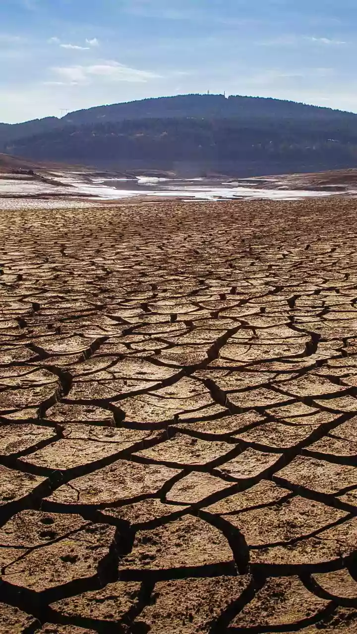
Reservoirs and Water Security
The impact extends far beyond the farms. The monsoon is essential for replenishing India's water reservoirs, which supply drinking water to hundreds of millions and fuel hydroelectric power plants. A dry June meant that reservoir levels, already low after the long summer, did not get their much-needed annual recharge. Data from the Central Water Commission showed that water storage in many of India's key reservoirs fell to alarmingly low levels, well below the 10-year average for this time of year. This raises concerns about potential water rationing in cities and a reduction in power generation if the rest of the monsoon season fails to compensate for the early deficit.
Is This the New Normal?
While a single weather event cannot be solely attributed to climate change, it fits a disturbing pattern. Climate scientists have long warned that a warming world will lead to more erratic and extreme monsoon behaviour. This includes long dry spells punctuated by intense, short bursts of rainfall, rather than the steady, predictable showers the agricultural calendar depends on. The record-breaking dryness of this June, caused by an unusually strong pre-monsoon cyclone, serves as a powerful reminder of the increasing vulnerability of India's weather systems. It underscores the urgent need for better water management, climate-resilient agricultural practices, and more accurate long-range weather forecasting to navigate an increasingly uncertain future.