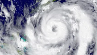





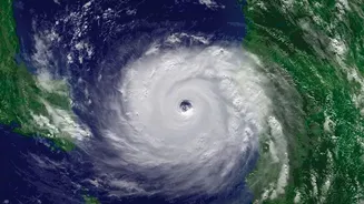

A powerful cyclonic storm named Arnab has now made landfall on India's east coast, prompting high alerts across several states. Here is what you need to know about the storm's path, potential impact, and crucial safety measures to follow.
Arnab's Landfall and Current Status
Cyclone Arnab
crossed the Andhra Pradesh coast as a 'Very Severe Cyclonic Storm' in the early hours of Wednesday, October 28. The landfall process was completed by approximately 8:30 am, with the storm's center moving entirely over land near Yanam. At the time of landfall, the cyclone packed maximum sustained wind speeds of 125-135 kmph, with gusts reaching up to 150 kmph. Following its landfall, the India Meteorological Department (IMD) has confirmed that the system has begun to weaken, and is expected to move northwest into the interior of the country, gradually losing intensity over the next 48 hours. However, authorities warn that the danger is not over, as heavy rainfall and strong winds will continue to affect the region.
States Under High Alert
Andhra Pradesh is bearing the most direct impact of the cyclone, with coastal districts experiencing destructive winds, extremely heavy rainfall, and storm surges. Tens of thousands of people have been evacuated from low-lying areas. Southern Odisha is also on high alert, bracing for very heavy rainfall and strong winds, which could lead to flooding and landslides in districts like Ganjam, Gajapati, and Malkangiri. The Odisha government has also evacuated thousands of residents from vulnerable areas as a precaution. Alerts for heavy rainfall have also been issued for parts of Telangana and Chhattisgarh as the storm system moves inland. Further afield, West Bengal is expected to receive heavy rainfall in its coastal and western districts.
Potential Impact and Disruptions
The primary threats from Cyclone Arnab are threefold: destructive winds, torrential rain, and storm surge. Winds up to 150 kmph can cause significant damage to infrastructure, including homes, communication lines, and power poles, with reports of uprooted trees already coming in. The IMD has warned of extremely heavy rainfall, which poses a major risk of widespread flooding in low-lying areas and flash floods in several districts across Andhra Pradesh, Odisha, and Telangana. Additionally, a storm surge of up to 1.5 meters above normal tide levels was forecast, threatening to inundate coastal areas. As a result, extensive disruptions have occurred, with numerous flights and train services cancelled, and fishing operations suspended along the affected coastline.
How to Stay Safe: Official Advisories
Authorities are urging residents in all affected regions to prioritize safety. The National Disaster Management Authority (NDMA) and state agencies have issued clear guidelines. If you are in an alert zone, stay indoors and away from windows. Do not venture outside until officials declare it is safe to do so. Ensure you have an emergency kit with essentials like nonperishable food, drinking water, medications, torches, and batteries. Charge your mobile phones and power banks. Fishermen have been strictly advised not to go out to sea until October 29. For those in lowly or vulnerable coastal areas, it is critical to follow all evacuation orders issued by local authorities and move to designated cyclone shelters. Stay updated by monitoring official bulletins from the IMD and announcements from local disaster management agencies.