




Monsoon Fury Across India
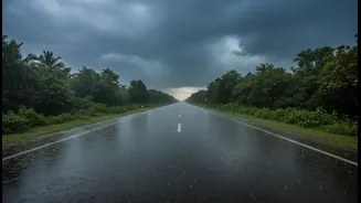
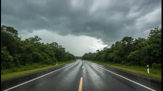
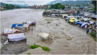
Across the country, the monsoon is in full force. States like Maharashtra, Gujarat, Kerala, and those in North India, including Delhi-NCR, are experiencing intense downpours leading to waterlogging and daily life being thrown out of gear. In Mumbai, record
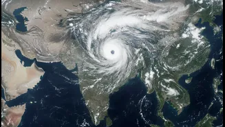
rains for early July have caused severe disruptions. Meanwhile, Delhi is on an 'Orange Alert', and flash flood warnings have been issued for regions in Rajasthan, Himachal Pradesh, and Uttarakhand. This widespread and intense rainfall is the result of a combination of weather systems, including a well-marked low-pressure area moving inland from the Bay of Bengal and the convergence of moisture-laden winds from the Arabian Sea. Understanding these complex interactions is where the view from space becomes indispensable.
The Eyes in the Sky
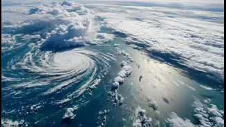
The India Meteorological Department (IMD) doesn't work alone; its crucial partner is the Indian Space Research Organisation (ISRO). For decades, ISRO's satellites, particularly the INSAT series (Indian National Satellite System), have served as our eyes in the sky. Satellites like INSAT-3D, INSAT-3DR, and others are designed specifically for meteorological observations. Positioned in geostationary orbit, they continuously monitor the Indian subcontinent and surrounding oceans, providing a constant stream of data that is fundamental to modern weather forecasting. This capability allows meteorologists to see the big picture, tracking cloud systems, cyclones, and the overall progression of the monsoon in real-time.
Decoding the Satellite Images
Satellite images are much more than just pictures of clouds. They provide data across different spectrums—visible, infrared, and water vapour—each telling a different part of the story. Infrared imagery is particularly useful as it measures temperature. Colder cloud tops indicate that the clouds have grown to a great height in the atmosphere, a hallmark of powerful thunderstorms that can produce intense rainfall. Water vapour channels show the concentration of moisture in the atmosphere, highlighting the atmospheric rivers or plumes that feed these massive rain systems. By analysing these images, forecasters can identify which cloud clusters are harmless and which are likely to lead to heavy downpours, tracking their movement and development with remarkable accuracy.
Connecting the Weather Systems
This year's intense rain in northern India is a classic example of multiple weather systems interacting. A Western Disturbance—an extratropical storm originating near the Mediterranean—moved eastward and interacted with the active monsoon trough over India. This confluence, fed by strong, moist winds from both the Arabian Sea and the Bay of Bengal, created a highly unstable atmosphere. Satellite imagery allows the IMD to watch this entire process unfold. They can track the moisture being pulled from the seas, see it converge over land, and observe the formation of the dense cloud bands that result in prolonged, heavy rainfall over states like Uttar Pradesh, Rajasthan, and Delhi.
Beyond Imagery: Data for Prediction Models
The role of satellites extends beyond direct imagery. Instruments called 'sounders' provide vertical profiles of the atmosphere's temperature and humidity, while 'scatterometers' measure wind speed and direction over the oceans. This wealth of data is fed into powerful supercomputers that run complex Numerical Weather Prediction (NWP) models. In fact, over 90% of the data used in these models is satellite-based. These models simulate the behaviour of the atmosphere, allowing the IMD to issue forecasts not just for the next few hours, but for several days in advance, with an accuracy that has improved by 20-30% thanks to satellite data assimilation.
Improving Forecasts and Saving Lives
The ultimate goal of this technology is to protect lives and property. By providing early and accurate warnings of heavy rainfall, cyclones, and flash floods, satellite data is a cornerstone of disaster management in India. Continuous monitoring helps authorities prepare for evacuations, manage reservoirs, and advise citizens to take necessary precautions. While challenges remain, especially in predicting highly localised events like cloudbursts, the constant advancements in satellite technology, like the recently launched INSAT-3DS, promise even greater resolution and more precise data, further strengthening India's resilience against the monsoon's power.