






Why Your Destination's Forecast Isn't Enough
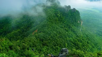
It’s a common mistake: you see a forecast for clear skies in your destination city and start packing. However, the journey itself is often where the greatest monsoon hazards lie. A serene hill station can be cut off by landslides on the roads leading
to it. Coastal highways can become impassable due to waterlogging from a localised downpour hundreds of kilometres from your endpoint. Heavy rains can reduce road capacity, leading to significant delays. The India Meteorological Department (IMD) frequently issues warnings for widespread rainfall that can disrupt transport across entire regions, not just in specific cities. These disruptions, including localized flooding and landslides, are the primary reason why a route-wide weather check is non-negotiable for safe monsoon travel.
The Hidden Dangers Along the Way
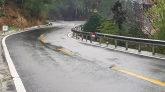
During the monsoon, roads are uniquely vulnerable. Persistent rain weakens the road's foundation, leading to the sudden appearance of potholes and even larger craters. This makes driving hazardous, as standing water can easily hide these dangers. In hilly areas, particularly the Himalayas and Western Ghats, the risk of landslides increases dramatically with prolonged rainfall. Even on plains, intense showers can cause flash floods and severe waterlogging, which can stall vehicles and create dangerous situations. Train journeys are not immune either, with tracks susceptible to flooding or damage, leading to long delays and diversions. Being aware of these potential issues along your entire path is the first step towards mitigating them.
Your Modern Weather Toolkit
Fortunately, technology has made route-specific planning easier than ever. The official MAUSAM app from the IMD provides forecasts, radar imagery, and proactive warnings for weather events across India. Another reliable, made-in-India option is Skymet Weather, which uses a vast network of automatic weather stations to provide detailed forecasts. For global coverage with strong performance in India, apps like AccuWeather offer features like MinuteCast, which predicts precipitation on a minute-by-minute basis. A lesser-known but powerful tool from the IMD is its Highway Forecast feature, specifically designed to give weather updates mapped across your entire route, helping you anticipate conditions as they unfold. Using a combination of these tools can provide a comprehensive weather picture for your journey.
How to Plan Your Route Check
Begin your planning a few days before your trip. First, map out your primary route using a service like Google Maps. Instead of just searching for the weather at your final stop, identify major towns, districts, or geographical features (like mountain passes) you will cross. Use your chosen weather apps to check the forecast for each of these key points for the approximate time you expect to be there. Pay close attention to warnings for heavy rain, thunderstorms, and strong winds. The IMD uses a color-coded alert system (green, yellow, orange, red) to indicate severity; a red or orange alert for any part of your route should prompt you to seriously reconsider your travel plans or timing. This proactive checking allows you to make informed decisions before you even start the engine.
Making Adjustments On the Go
A pre-trip check is essential, but the unpredictable nature of the monsoon means you must stay vigilant while travelling. Keep your weather apps handy and check for updates during breaks in your journey. If you encounter poor visibility or waterlogged roads, it's safer to pull over at a secure location and wait for conditions to improve. Never attempt to drive through flooded areas, as it's impossible to know the water's depth or the condition of the road beneath. Having a flexible itinerary is your greatest asset. Be prepared to change your route, delay your travel by a day, or even alter your plans entirely if you encounter severe weather warnings. The goal is to arrive safely, not just quickly.