







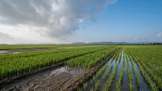
An Erratic Season So Far
The 2026 monsoon has been a story of extremes. The season began with a significant deficit in June, followed by a recovery in July that brought relief but also intense rain bursts in some regions. However, August proved to be unusually dry and was confirmed
by the India Meteorological Department (IMD) as the warmest August since record-keeping began in 1901. This erratic behaviour, with some regions facing floods while others remained parched, has left the country with an overall rainfall deficit. As of early September, cumulative rainfall remains below the long-period average, with southern peninsular India and the east and northeast facing the largest shortfalls.
Decoding the 'Monsoon Break'
So, what exactly is this 'lull' or 'break'? Meteorologically, it's a well-known phenomenon. It occurs when the monsoon trough, a low-pressure belt that is the lifeblood of the rainy season, shifts northwards towards the foothills of the Himalayas. This shift leads to heavy rain in the northeastern states and along the mountains but causes rainfall to significantly decrease across the vast plains and peninsular India. While breaks are a normal part of the monsoon cycle, their duration and timing are critical. The current lull has been attributed to the absence of strong low-pressure systems forming in the Bay of Bengal, which are crucial for pulling the monsoon trough south and driving widespread rain across the mainland.
The All-Important September Forecast
The critical question is whether the rains will return. According to the IMD's forecast released at the end of August, rainfall for September is expected to be below normal for the country as a whole. However, this doesn't mean the season is over. The IMD and other weather models predict a potential revival of rainfall activity from the second week of September, particularly over central and eastern parts of the country. A low-pressure area developing over the Bay of Bengal is expected to bring fairly widespread rain to states like Chhattisgarh, Odisha, and Madhya Pradesh. While rainfall may remain subdued over the peninsula for another week, the monsoon has not officially withdrawn.
Impact on Fields and Finances
The timing of this dry spell is precarious. It coincides with a critical growth stage for many kharif crops, including rice, pulses, and oilseeds. Insufficient rainfall now could directly impact yields and overall production. The US Department of Agriculture's Foreign Agricultural Service has already lowered its production forecast for Indian rice and corn for the 2026-27 season, citing the erratic monsoon. Beyond the fields, a weak end to the monsoon affects reservoir levels, which are vital for winter (Rabi) crop irrigation and hydroelectric power generation. A prolonged dry spell increases reliance on groundwater, raising energy demand and costs for farmers.
A Glimpse into the Future
This year's monsoon performance is playing out against the backdrop of strengthening El Niño conditions, a climate pattern that is historically linked to weaker monsoon rains and warmer temperatures in India. The IMD has noted the influence of El Niño on the record-breaking heat in August and the overall rainfall patterns. While it is too early to declare a formal withdrawal of the monsoon, which is a process that typically begins from northwest India after September 15, the current situation serves as a stark reminder of the monsoon's complexities. The focus now shifts to the revival systems in the Bay of Bengal, which hold the key to the final performance of this crucial season.