





A New Perspective from Orbit
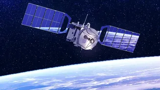
At its core, Earth Observation (EO) is exactly what it sounds like: using satellites to monitor our planet's physical, chemical, and biological systems. For decades, this technology has been quietly gathering data, but recent advancements have turned
it into a game-changing tool for disaster management. Instead of being limited to ground-level views, forecasters can now get a comprehensive, near real-time picture of vast areas from hundreds of kilometres above. This bird's-eye view is crucial for understanding a flood's potential scale and path before it fully develops.
The Limits of Traditional Methods
Traditionally, flood forecasting relied on ground-based methods. Think of river gauges measuring water levels at specific points, rain gauges collecting precipitation data, and manual land surveys. While valuable, these tools have significant limitations. They only provide information for the exact location where they are installed, creating blind spots in vast, remote, or inaccessible regions. Data collection can be slow and physically dangerous during extreme weather. This often meant that by the time authorities had a clear picture of the threat, the water was already rising, leaving little time for effective action.
Seeing Through the Storm with SAR
One of the most significant breakthroughs in EO for flood forecasting is Synthetic Aperture Radar (SAR). Unlike optical satellites that work like a camera and are blinded by clouds or darkness, SAR is an active sensor. It sends its own microwave pulses to the Earth's surface and measures the signal that bounces back. Calm water acts like a mirror, reflecting the signal away from the satellite, which makes it appear dark in a SAR image. This creates a stark, high-contrast map of inundated areas. Critically, SAR can 'see' through cloud cover, rain, and at night, providing uninterrupted monitoring when it's needed most. This all-weather, day-and-night capability ensures that disaster managers receive a constant flow of information, regardless of conditions on the ground.
From Data to Life-Saving Decisions
The satellites themselves are only one part of the equation. The real power comes from feeding this stream of data—on rainfall, soil moisture, river width, and inundated land—into sophisticated computer models. In India, organizations like the Indian Space Research Organisation (ISRO) play a pivotal role. ISRO uses its constellation of satellites to monitor flood situations in near real-time, creating inundation maps that are disseminated to national and state disaster management authorities. By comparing pre- and post-event imagery and integrating satellite data with digital elevation models, these systems can predict how water will move across the terrain, identifying which villages and infrastructure are at highest risk.
The Proactive Payoff: Earlier and Better Warnings
The shift to satellite-based forecasting is moving disaster management from a reactive to a proactive stance. Instead of confirming damage after it happens, authorities can now anticipate it. This technology enables earlier and more accurate warnings, giving people more time to evacuate. It allows for more precise resource allocation, ensuring that rescue teams and relief supplies are sent where they are most needed. Post-flood, satellite imagery provides a rapid and safe way to assess the full extent of the damage to crops, homes, and infrastructure, which is crucial for recovery efforts. This ability to see the bigger picture quickly and accurately saves not only money and resources, but most importantly, it saves lives.








