


Smarter Farming from the Stars
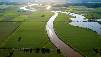
For generations, Indian agriculture has been a gamble on the monsoon. Today, data from satellites is helping to stack the odds in the farmer's favour. The Indian Space Research Organisation (ISRO), in collaboration with the Ministry of Agriculture, has been leveraging
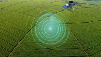
satellite technology to revolutionise farming. Programmes like FASAL (Forecasting Agricultural output using Space, Agrometeorology and Land-based observations) use satellite data to forecast crop yields for staples like rice and wheat. This information is vital for planning, pricing, and ensuring national food security. On a more granular level, the Krishi-Decision Support System (Krishi-DSS) provides farmers with real-time data on soil moisture, weather patterns, and even early warnings about pest outbreaks, allowing for more precise and efficient use of resources like water and fertiliser. Studies have shown that using satellite-based advisories can improve crop productivity by 2 to 5 percent while reducing input costs.
Predicting Calamity, Saving Lives
India's diverse geography makes it vulnerable to a range of natural disasters, from cyclones and floods to droughts and landslides. Here, Earth Observation (EO) satellites serve as a vital early warning system. Meteorological satellites operated by the India Meteorological Department (IMD) and ISRO track the formation and movement of cyclones, enabling authorities to issue timely evacuation alerts. During floods, radar imaging satellites, which can see through clouds, help identify the extent of inundated areas, guiding rescue and relief operations in near real-time. Beyond reactive measures, satellite data also aids in proactive planning. The National Agricultural Drought Assessment and Monitoring System (NADAMS) uses satellite information on vegetation health and soil moisture to provide early assessments of drought conditions, allowing for intervention before a crisis fully develops.
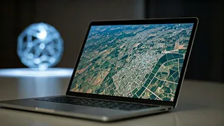
Building Better Cities from Above
As India's urban areas continue to expand, managing this growth sustainably is a major challenge. Satellite data provides urban planners with a powerful macro-level view that is impossible to get from the ground. High-resolution imagery from satellites like ISRO's Cartosat series helps monitor urban sprawl, map land use changes, and identify illegal construction. This data is critical for planning new infrastructure, such as roads, public transport networks, and utilities, ensuring they are placed where they are needed most. Furthermore, specialised data can be used to monitor the health of urban infrastructure, such as detecting pipeline leaks or assessing the risk to buildings in hazard-prone zones. Startups are now developing 'digital twins' of cities, using satellite data and AI to create virtual models for simulating and planning urban development.
The New Frontier for Indian Startups
The democratisation of space data, driven by government policies like the Indian Space Policy 2023, has ignited a thriving startup ecosystem. Companies are no longer just building satellites; they are focused on turning vast streams of data into actionable business intelligence. Startups like SatSure are providing data analytics for agriculture and financial services, while GalaxEye is developing satellites with combined optical and radar sensors for all-weather monitoring. This shift from providing raw data to offering 'Data-as-a-Service' (DaaS) is a key trend. Indian startups are now competing on a global stage, offering services for everything from crop monitoring and infrastructure planning to climate risk assessment, feeding a growing global hunger for satellite data.