






The Challenge of a Treacherous Coastline
India's monsoon is a complex weather phenomenon, delivering about 75% of the country's annual rainfall. For coastal communities, however, this season brings heightened risks. Cyclones can form rapidly over the warm waters of the Arabian Sea and Bay of Bengal,
bringing torrential rains, storm surges, and destructive winds. Historically, forecasting the exact intensity and landfall of these systems was a challenge. Ground-based weather stations and buoys provide vital data, but they offer a limited view. Meteorologists needed a way to see the bigger picture—to track the formation of weather systems far out at sea and monitor their development in real-time, day or night.
ISRO's Eyes in the Sky
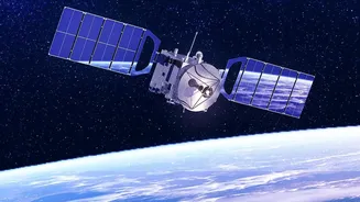
The Indian Space Research Organisation (ISRO) has deployed a sophisticated fleet of Earth observation satellites that act as our celestial sentinels. This multi-pronged approach provides a comprehensive view of the atmosphere and ocean. Geostationary satellites like the INSAT series (including INSAT-3D, INSAT-3DR, and the new INSAT-3DS) hover in a fixed spot about 36,000 km above Earth, providing constant, uninterrupted surveillance of the Indian subcontinent. They are the workhorses of weather forecasting, equipped with advanced imagers and sounders that capture a holistic view of atmospheric conditions. These are complemented by polar-orbiting satellites like the Oceansat series, which circle the globe to gather specific data on the oceans, a key driver of monsoon weather.
More Than Just a Cloud Picture
What makes these new sensors a game-changer is the sheer detail and variety of data they collect. The imagers on INSAT satellites don't just take a simple picture; they capture data across multiple spectral channels, from visible light to thermal infrared. The infrared channels are particularly crucial as they can measure the temperature of cloud tops. Extremely cold, bright white cloud tops in an infrared image signify towering cumulonimbus clouds, often rising over 15 kilometres high, which are factories for intense rainfall and severe thunderstorms. Furthermore, atmospheric sounders provide vertical profiles of temperature and humidity, giving forecasters a 3D understanding of the atmosphere’s structure and stability. This helps predict the likelihood of sudden, violent downpours along the coast.
Understanding the Ocean's Engine
Cyclones are born over the ocean, and understanding ocean conditions is critical to predicting their behaviour. This is where ISRO’s Oceansat-3 (also known as EOS-06) comes in. Its scatterometer instrument (OSCAT-3) measures the speed and direction of winds at the sea surface, allowing meteorologists to spot the tell-tale signs of a rotating weather system long before it becomes a full-blown cyclone. At the same time, other instruments on board measure Sea Surface Temperature (SST) with high accuracy. Warmer sea temperatures provide more fuel for cyclones, and tracking these warm pools helps predict how a storm might intensify as it approaches the coastline. This data is indispensable for issuing timely and accurate cyclone warnings.
The All-Weather Advantage of Radar
One of the biggest obstacles during the monsoon is the monsoon itself. Thick cloud cover can blind traditional optical satellites, hiding what's happening on the ground. To solve this, ISRO uses Radar Imaging Satellites (RISAT) equipped with Synthetic Aperture Radar (SAR). SAR is an active sensor; it sends its own microwave signal to the ground and reads the reflection. Because these microwave signals can penetrate clouds, haze, and rain, RISAT can provide clear images of the surface day or night, regardless of the weather. This capability is revolutionary for flood management. Calm, standing water reflects the radar signal away from the satellite, appearing as dark patches in the final image. This allows disaster management agencies to map the precise extent of flooding in coastal and inland areas in near real-time, even when the area is blanketed by storm clouds.