


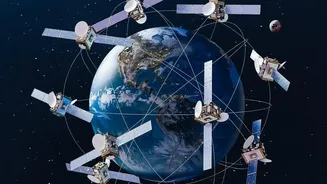
Our Planet's Health Check from Orbit
Monitoring glaciers and snow cover is critical for understanding climate change and managing water resources for millions of people. These frozen reservoirs are often located in remote, inaccessible, and dangerous terrains, making on-the-ground study
difficult and expensive. Satellites provide the perfect solution, offering a continuous, bird's-eye view that allows scientists to track changes over vast areas consistently. However, it's not a one-size-fits-all job. Different types of satellites act like a team of specialists, each equipped with unique tools to measure different aspects of the ice, from its total area to its thickness and even its weight. By combining their data, researchers can build a comprehensive health report for the planet's cryosphere—its frozen parts.
Mapping the Footprint with Optical Satellites
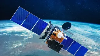
The most straightforward way to see how much area a glacier covers is to take a picture of it. Optical satellites, like those in the American Landsat series or India’s own Resourcesat series, essentially work like powerful digital cameras in space. They capture images in visible and infrared light. Since snow and ice are bright and highly reflective compared to the surrounding land and water, they stand out clearly in these images. Scientists can then use this data to map the precise boundaries of snow and glacier cover and track how their footprint shrinks or grows over time. The major drawback of this method is that it relies on clear skies. Persistent cloud cover, common in mountainous regions, can block the view, creating gaps in the data.
Seeing Through Clouds with Radar
To overcome the problem of cloud cover, scientists turn to radar satellites, such as the European Space Agency's Sentinel-1 or the joint NASA-ISRO NISAR mission. Unlike optical satellites that passively capture reflected sunlight, radar instruments are active. They send out their own microwave pulses towards the Earth and measure the signals that bounce back. These microwaves can penetrate through clouds, darkness, and even dry snow, providing an uninterrupted view of the ice below. This technology is not only useful for mapping area but can also track the speed at which glaciers flow, a key indicator of their health. Furthermore, the upcoming NISAR mission is specifically designed to help monitor glacial lakes in the Himalayas, which is crucial for assessing flood risks.
Measuring Thickness with Lasers and Radar
Knowing the area of a glacier is one thing, but understanding how much ice it's truly losing requires measuring its thickness. This is the job of satellite altimeters. Missions like NASA's ICESat-2 use a laser altimeter, which sends down precise pulses of light and times how long they take to reflect off the ice and return to the satellite. This allows for incredibly detailed measurements of the ice surface's height. By comparing these height maps over months and years, scientists can calculate how much the volume of the ice sheet is changing. Radar altimeters, like the one on CryoSat-2, perform a similar function using radar waves. Together, these 'measuring tapes in the sky' provide a 3D view of ice loss.
Weighing the Ice from Space
Perhaps the most mind-bending technique involves weighing entire ice sheets from orbit. This is done by a pair of satellites in the GRACE (Gravity Recovery and Climate Experiment) and its successor, GRACE-FO. These twin satellites fly one after the other in the same orbit. The Earth's gravity is not uniform; it's slightly stronger over areas with more mass. As the lead satellite approaches a massive ice sheet, it is pulled forward slightly by the extra gravity, increasing the distance between it and its twin. As it passes, the effect reverses. By using a microwave ranging system to measure the minuscule changes in the distance between them with extreme precision, scientists can map Earth's gravity field. When an ice sheet loses billions of tons of ice, it creates a tiny but measurable dip in the local gravity, which the GRACE satellites detect. This provides a direct measurement of the total ice mass lost over huge areas like Greenland and Antarctica.