

A Catastrophe of Earth-Shaking Proportions
In recent years, Nepal has witnessed devastating flash floods that defy imagination. A notable example is the 2021 Melamchi River flood, a disaster that swept away homes, bridges, and infrastructure, displacing thousands. But beyond the visible destruction,
something else was happening. Scientists monitoring seismic activity in the region noticed a strange signal. It looked like an earthquake, but its signature was different—a prolonged, energetic rumble that coincided with the flood. Initially, there was confusion; some reports suggested an earthquake had triggered a landslide, which then caused the flood. However, further analysis by institutions like the US Geological Survey revealed a startling truth: there was no tectonic earthquake. The flood itself was the source of the seismic energy.
How a River Can Mimic an Earthquake
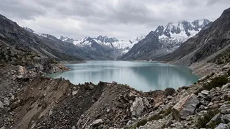
So, how can water flowing in a river shake the solid earth? The answer lies in the immense power and composition of Himalayan flash floods. These aren't just events of rising water; they are often debris flows, a terrifying slurry of water, mud, sediment, and massive boulders. This phenomenon, studied under a branch of science called fluvial seismology, occurs when an event like a landslide, glacial lake outburst, or an ice-rock avalanche dumps enormous amounts of material into a river channel. As this torrent of debris—weighing millions of tonnes—thunders down steep mountain valleys, the colliding and grinding of giant boulders along the riverbed generates intense vibrations. This process transmits low-frequency seismic waves through the ground, which are then picked up by seismometers, sometimes hundreds of kilometres away. The resulting signal is what scientists have dubbed a 'floodquake' or a flood's seismic signature.
The Science of Cascading Hazards
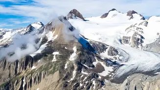
The events in Nepal are a textbook example of 'cascading hazards,' where one disaster triggers another in a deadly chain reaction. It often begins high in the mountains. Unusually heavy rainfall or rapid snowmelt can destabilize a slope, causing a massive landslide or a rock-ice avalanche. This debris can then crash into a river, sometimes forming a temporary dam. When the dam inevitably bursts under the pressure of the backed-up water, it releases a sudden, high-energy flood wave packed with the very debris that formed the dam. This was the suspected mechanism in the catastrophic Melamchi flood. The seismic signal is therefore not from the water alone, but from the entire destructive land-moving event that accompanies the flood.
A Fingerprint That Could Save Lives
While terrifying, this discovery has a profound and life-saving application. Seismic waves travel through the ground much faster than floodwaters travel down a river. A seismometer located downstream could detect the 'floodquake' signal minutes, or even an hour, before the destructive debris flow arrives. This could provide a critical window of time to issue evacuation warnings to communities in the flood's path. In a region where traditional flood warning systems are often hampered by the remote terrain and the suddenness of such events, using seismic networks as a flood detection tool could be revolutionary. It offers a way to 'hear' the flood coming long before it can be seen, turning a scientific curiosity into a practical early warning system for some of the world's most vulnerable communities.
A Warning for the Entire Himalayan Region
This phenomenon isn't exclusive to Nepal. The entire Himalayan region, including states across northern India, faces similar risks. The combination of steep topography, fragile geology, and the intensifying impacts of climate change—such as more extreme rainfall and faster glacier melt—is increasing the frequency and severity of these cascading disasters. Events like the Chamoli disaster in Uttarakhand had similar characteristics, involving a rock-ice avalanche that triggered a devastating flood. Understanding that these floods have a seismic fingerprint is a crucial piece of the puzzle in building resilience. It underscores the urgent need for cross-border cooperation on disaster monitoring and data sharing, as these mighty rivers and the hazards they carry do not respect international boundaries.