




What Exactly Is El Niño?
El Niño is a climate pattern that begins in the tropical Pacific Ocean. In a normal year, strong trade winds blow from east to west, pushing warm surface water towards Asia and Australia. During an El Niño event, which happens every two to seven years,
these winds weaken or even reverse. This allows the warm water that is normally in the western Pacific to spread eastward, towards the coast of South America. This seemingly simple shift—a warming of the central and eastern Pacific Ocean—sets off a chain reaction, disrupting weather patterns across the globe.
The Pacific's Ripple Effect on India
How can warm water off the coast of Peru affect rainfall in Pune? The answer lies in the atmosphere. The warming of the Pacific Ocean during an El Niño disrupts a massive atmospheric circulation pattern known as the Walker Circulation. This circulation is like a giant conveyor belt that usually helps bring moisture-laden winds towards the Indian subcontinent. When El Niño kicks in, this atmospheric engine weakens. The result is that the southwest monsoon winds, which are crucial for India's June-to-September rainy season, can lose strength. This disruption often leads to suppressed rainfall over large parts of India.
The Real-World Impact on India
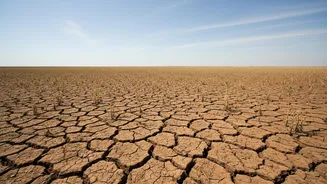
A weaker monsoon is not just a weather headline; it has severe, tangible consequences for India. Agriculture, which employs nearly half of the country's workforce, is the most vulnerable sector. A deficit in monsoon rains can lead to delayed crop sowing, reduced yields, and outright crop failure, particularly for rain-fed crops like rice, soybean, and cotton. This directly impacts farmers' incomes and can trigger broader economic problems, including food price inflation as supply chains are squeezed. Beyond the farms, deficient rainfall means lower water levels in reservoirs, affecting drinking water supplies and the generation of hydroelectric power.
Not Every El Niño Means Drought
While the correlation between El Niño and a poor monsoon is strong, it's not a perfect one-to-one relationship. Not every El Niño year has resulted in a drought in India. Other climate factors play a crucial role. One of the most significant is the Indian Ocean Dipole (IOD), sometimes called the Indian Niño. The IOD is the Indian Ocean's own version of El Niño, involving temperature differences between the western and eastern parts of the ocean. A 'positive' IOD, with warmer waters in the western Indian Ocean, can help bring rain to India and sometimes counteract the negative effects of an El Niño. Conversely, a 'negative' IOD can worsen its impact. The interplay between these two phenomena makes monsoon forecasting a complex challenge.
The 2026 Monsoon and El Niño
The developing El Niño in 2026 is being watched closely, with forecasts from agencies like the U.S. National Oceanic and Atmospheric Administration (NOAA) suggesting it could become a historically strong event. In India, the impact has already been felt. The India Meteorological Department (IMD) had predicted a below-normal monsoon for 2026, anticipating the development of El Niño conditions. After a significantly deficient June, the cumulative seasonal rainfall across the country remained below average as of early August. Private forecasters like Skymet have even downgraded their predictions, citing the strengthening El Niño and raising the probability of a drought. These conditions have already led to moisture stress on crops and concerns over water reservoir levels.