

The Grand Vision: Rivers as Highways
India is betting big on its rivers. Under the National Waterways Act of 2016, the government identified 111 rivers and canals to be developed into National Waterways (NWs). The goal is to create a cost-effective and environmentally friendlier alternative
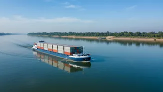
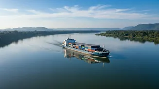
for transporting goods, especially bulk cargo like coal, cement, and food grains. The flagship Jal Marg Vikas Project (JMVP) focuses on enhancing navigation on the Ganga (NW-1), with similar efforts on the Brahmaputra (NW-2) and other rivers. The government's vision is to increase the share of inland water transport (IWT) from its current 2% to 5% by 2030, a move that could transform the country's logistics landscape. Cargo movement on these waterways has already seen a significant surge, indicating growing momentum.
Why the Clock is Ticking
Building terminals and dredging channels is only half the battle. For businesses to shift from the predictability of road and rail to water, they need one crucial thing: reliability. In modern logistics, just-in-time manufacturing and lean supply chains are the norm. Companies cannot afford to have raw materials or finished products stuck on a river for an unknown duration. Predictable, fixed schedules are the backbone of supply chain confidence. Without the assurance that a vessel will depart and arrive on time, businesses will hesitate to invest in IWT, undermining the entire project. This makes achieving clockwork precision not just a desirable feature, but a core requirement for the waterways' economic viability.
Nature's Timetable vs. Commerce's Clock
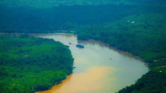
Operating a logistics network on a living river system presents unique challenges that trucks and trains don't face. India's rivers are subject to dramatic seasonal variations. The monsoon can bring flooding and high currents, while the dry season can lead to dangerously low water levels, or draft, making navigation impossible for larger vessels. Siltation is a constant battle, requiring continuous dredging to maintain navigable depths. Furthermore, many bridges have low clearance, restricting the size of vessels that can pass underneath. These natural and infrastructural hurdles make fixed scheduling a complex puzzle that requires more than just a paper timetable to solve.
Technology as the Navigator
To master the challenges of river transport, India is turning to technology. A key innovation is the implementation of River Information Systems (RIS). Much like air traffic control, RIS uses a combination of AIS transponders, radar, and real-time meteorological and hydrological data to track vessels and manage traffic. This allows for better route planning, collision avoidance, and the ability to provide vessels and cargo owners with accurate Estimated Times of Arrival (ETAs). Digital navigation charts and the development of night navigation facilities are also being deployed to extend operational hours and increase efficiency, transforming once-unpredictable rivers into manageable, 24/7 transport corridors.
The Economic Ripple Effect
If India can successfully solve the scheduling challenge, the benefits will be immense. A reliable IWT network promises to significantly lower logistics costs, which can constitute a large portion of product prices. Shifting cargo from overcrowded roads and railways will reduce congestion and lower the nation's carbon footprint, as water transport is significantly more fuel-efficient. The development of multi-modal terminals, which connect waterways to road and rail networks, is creating an integrated logistics ecosystem. This will not only boost trade but also spur economic development in the regions along the riverbanks, creating jobs and new opportunities far beyond the major industrial hubs.