



A New Eye Above Earth
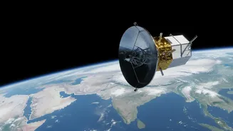
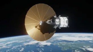
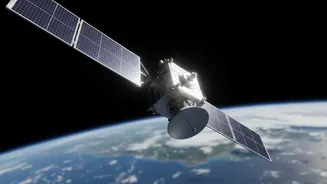
The NISAR (NASA-ISRO Synthetic Aperture Radar) mission is a landmark collaboration between the Indian Space Research Organisation (ISRO) and the US National Aeronautics and Space Administration (NASA). After its launch, the satellite is now in its operational
phase, capturing and releasing a staggering amount of data about our planet's surface. Unlike traditional satellites that take pictures like a camera, NISAR uses a sophisticated radar system. This allows it to scan nearly all of Earth's land and ice surfaces with remarkable frequency, imaging the entire globe every 12 days. The mission's recent commencement of daily data releases through ISRO's Bhoonidhi portal marks a pivotal moment, providing scientists and the public with a near-real-time view of Earth's dynamic changes.
The Magic of 'Cloud-Penetrating' Radar
The technology at the heart of NISAR is Synthetic Aperture Radar, or SAR. Think of it less like a camera and more like an ultrasound for the planet. SAR doesn't need sunlight; it actively sends out its own microwave signals towards the ground and measures the 'echoes' that bounce back. This is what allows it to 'see' through obstacles like clouds, rain, smoke, and the darkness of night. For a country like India, where the monsoon season blankets vast regions in clouds for months, this all-weather, 24/7 capability is a game-changer. While optical satellites are blind during cloudy weather or at night, SAR provides a continuous, reliable stream of information about what is happening on the ground, capturing details about surface texture, roughness, and moisture.
Why Daily Data Is a Big Deal
While radar satellites are not new, the sheer volume and frequency of NISAR's data are unprecedented. The mission generates more data on a daily basis than any previous Earth satellite from either NASA or ISRO. This constant stream of high-resolution images allows scientists to move from taking occasional snapshots to watching the Earth's processes unfold almost like a movie. This is critical for tracking rapidly evolving events. For example, disaster response teams can get expedited 'Urgent Response' data to see the extent of flooding or damage from a landslide within hours, not days, which is crucial for saving lives and directing resources. This constant monitoring enables a much deeper understanding of subtle changes that occur over days and weeks, not just seasons or years.
Transforming Life in India
For India, NISAR’s applications are vast and transformative. The mission will systematically monitor the subcontinent, providing crucial data for managing key resources and hazards. This includes tracking the health of Himalayan glaciers, whose meltwater is vital for millions. In agriculture, it can assess crop health and soil moisture, even during the cloudy monsoon season, helping to improve food security. It will provide invaluable insights for disaster management by monitoring landslide-prone areas, tracking floodwaters, and even detecting tiny surface movements that could be precursors to earthquakes or volcanic activity. ISRO has identified these areas as key priorities, making NISAR a vital tool for national development and safety.
A Global Partnership for the Planet
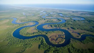
NISAR represents a major achievement in international scientific collaboration. The satellite is equipped with two radar systems: an L-band radar provided by NASA and an S-band radar provided by ISRO. This dual-frequency approach allows for a more comprehensive study of everything from forest biomass to ground deformation. The mission's data is free and open to the public, ensuring that researchers, governments, and innovators around the world can use it to better understand and protect our planet. As recent images from the mission have shown—from flooding in Mozambique to a stunning 'hummingbird' shape in Antarctic ice—NISAR is already providing new ways of seeing and understanding Earth's complex systems.