







The Ever-Present Coastal Threat
A storm surge is often the most dangerous element of a cyclone. It’s a rapid rise in sea level, a massive bulge of water pushed ashore by powerful cyclonic winds. This isn’t a normal tide; it’s a coastal flood that can sweep kilometres inland, destroying
homes, infrastructure, and agricultural land with terrifying speed. For India's densely populated coastal regions, getting timely and accurate warnings is not just a matter of convenience—it's a matter of life and death. Historically, predicting the exact height and reach of a surge has been challenging, relying on models that had limitations, especially when a storm’s fury obscures the view from conventional weather satellites.
Seeing Through the Storm
Traditional optical satellites are like human eyes; they can’t see through thick clouds or in the darkness of night. This is a major drawback when trying to monitor a cyclone, which is, by its very nature, a mass of swirling clouds. This is where the game-changing upgrade comes in: Synthetic Aperture Radar, or SAR. Think of SAR as a satellite with superpowers. It doesn’t rely on light; instead, it sends out its own microwave pulses and reads the echoes that bounce back. These microwaves slice straight through clouds, rain, and darkness, providing a clear, detailed picture of the sea surface and coastline, day or night, in any weather. This all-weather capability is the foundational upgrade that allows for continuous, uninterrupted monitoring when it's needed most.
The Power of Two Frequencies
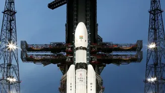
The most significant leap forward is embodied in the NASA-ISRO Synthetic Aperture Radar (NISAR) mission, a groundbreaking collaboration. NISAR is the first satellite of its kind to use two different radar frequencies simultaneously: the L-band (provided by NASA) and the S-band (developed by ISRO). This dual-frequency approach is a force multiplier. Each frequency interacts with the Earth’s surface differently. The longer wavelength L-band can penetrate vegetation to see the ground beneath, while the S-band is excellent for monitoring things like soil moisture and the texture of the sea surface. By combining the data from both, scientists can filter out distortions caused by heavy rain and the ionosphere, creating a much clearer and more accurate picture. This allows them to measure subtle changes in sea level and wave patterns that are critical for forecasting a storm surge's intensity and potential inundation area.
From Pixels to Precise Predictions
The high-tech radar on NISAR doesn't just see through clouds; it sees with incredible precision. The satellite can detect changes in the Earth's surface as small as a centimetre from its orbit hundreds of kilometres away. When a cyclone approaches the coast, this allows ISRO to map the build-up of water with remarkable detail. The data can reveal exactly which low-lying areas are beginning to flood and how fast the water is moving. By comparing images taken just days apart, analysts can create near real-time inundation maps. Instead of issuing a general warning for a large coastal district, disaster management agencies can receive specific intelligence, pinpointing the villages and neighbourhoods at greatest risk. This level of detail transforms how authorities plan evacuations and deploy resources.
A New Era in Disaster Management
The raw data from space is just the beginning. At centres like ISRO's National Remote Sensing Centre, this complex information is rapidly processed into usable products. These detailed maps and analyses are then disseminated to the India Meteorological Department (IMD) and the National Disaster Management Authority (NDMA). Armed with this high-resolution, reliable information, these agencies can issue more accurate and timely alerts to the public. The enhanced capability helps in everything from estimating the number of people who need to be evacuated to identifying safe shelter locations and planning post-cyclone relief efforts. This fusion of cutting-edge space technology and on-ground disaster response represents a significant strengthening of India's coastal defence against natural calamities, promising to save more lives and reduce economic damage.