



A New Green Revolution from Space
For millions of Indian farmers, the vagaries of weather and soil health have always been a gamble. Today, satellite technology is helping to stack the odds in their favour. The Indian Space Research Organisation (ISRO) is at the forefront of this change,
using its remote sensing satellites to provide a wealth of agricultural intelligence. Programs like Forecasting Agricultural output using Space, Agro-meteorology and Land-based observations (FASAL) provide pre-harvest production forecasts for major crops, allowing for better planning and market stability. Satellites can assess soil moisture levels, monitor crop health by analysing the light they reflect, and even detect pest attacks before they become visible to the naked eye. This data is funnelled into decision support systems like Krishi-DSS, which empower farmers with timely, farm-specific advice.
Smarter Farming, Field by Field
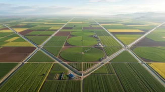
The benefits extend to the very inputs that define modern farming. Satellite imagery enables precision agriculture, a method where resources are applied exactly where they are needed. Instead of blanket-fertilising an entire field, data can pinpoint areas with specific nutrient deficiencies, allowing for targeted application. This not only reduces costs for farmers but also minimises environmental impact. Water management, a critical issue across India, is also being revolutionised. Satellites assist in groundwater prospecting and monitor reservoir levels, aiding in efficient irrigation. Furthermore, this technology has become a cornerstone of the Pradhan Mantri Fasal Bima Yojana (PMFBY), the government's crop insurance scheme. Satellite data is used to assess crop damage from natural calamities, making claim settlements faster, more accurate, and less prone to fraud.
Eyes on the Storm
When cyclones gather strength over the Bay of Bengal or the Arabian Sea, every hour of warning counts. India's meteorological satellites, like the INSAT series, are the nation's first line of defence. They provide continuous, real-time tracking of weather systems, allowing the India Meteorological Department (IMD) to predict a cyclone's path, intensity, and potential landfall with increasing accuracy. This crucial information enables disaster management agencies to issue timely warnings and carry out large-scale evacuations, saving countless lives. The satellites' all-weather capabilities, particularly from Radar Imaging Satellites (RISAT), ensure that monitoring is uninterrupted, even by heavy cloud cover that would obscure conventional cameras. This constant watch is vital for a country with a long and densely populated coastline vulnerable to extreme weather events.
Mapping a Path from Rescue to Recovery
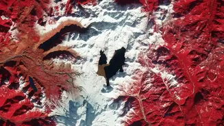
The role of satellites doesn't end when a storm passes or the ground stops shaking. In the chaotic aftermath of a disaster, high-resolution imagery becomes critical for response and recovery. The National Remote Sensing Centre (NRSC) rapidly provides data to map the extent of damage from floods, landslides, and earthquakes. These maps are invaluable for the National Disaster Management Authority (NDMA) and state agencies, helping them identify the worst-hit areas, locate villages that have been cut off, and plan the safest routes for rescue teams. Platforms like ISRO's Bhuvan geoportal and the National Database for Emergency Management (NDEM) integrate this spatial data, providing a unified operational picture for administrators to coordinate relief efforts, from deploying aid to planning long-term reconstruction.