



Our Eyes in the Sky
Before the 1960s, weather forecasting was a ground-level affair, relying on surface reports and observations from ships and planes. The launch of the first weather satellites completely changed the game, giving meteorologists a view of cloud patterns
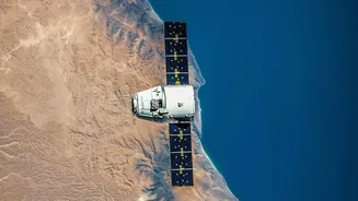
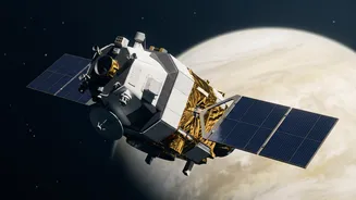
and weather systems that was previously impossible. Today, a fleet of sophisticated satellites orbits Earth, acting as our indispensable eyes in the sky. They fall into two main categories: geostationary and polar-orbiting. Geostationary satellites are positioned high above the equator, moving at the same speed as the Earth's rotation. This allows them to hover over the same spot, providing continuous monitoring that is essential for tracking rapidly developing events like cyclones and severe thunderstorms. Polar-orbiting satellites fly much closer to Earth, travelling from pole to pole. As the planet rotates beneath them, they are able to scan the entire globe over time, capturing high-resolution imagery and detailed data vital for long-range forecasting and climate studies.
The Tools of the Trade
Weather satellites are much more than just cameras; they are flying laboratories packed with advanced instruments. The most important of these are radiometers, which measure energy radiated from the Earth and its atmosphere. These instruments include imagers and sounders. Imagers capture what we typically see as satellite photos, observing in visible and infrared light. This allows them to see cloud cover during the day and, by measuring heat, see cloud structures even at night. Sounders are even more remarkable. They measure temperature and humidity at different altitudes throughout the atmosphere, creating a vertical profile of atmospheric conditions. This three-dimensional data is a critical ingredient for modern weather models. Other specialized sensors can measure wind speed and direction over the oceans, detect the unique signatures of volcanic ash and smoke from wildfires, and even map lightning strikes in real-time.
From Data to Daily Forecasts
The raw data beamed down from these satellites—measurements of radiation across different wavelengths—isn't a weather map. This information is fed into powerful supercomputers on the ground, which run complex numerical weather prediction models. These models use the satellite data as a starting point to simulate how the atmosphere will behave over the coming hours and days. The continuous stream of information on cloud temperature, moisture levels, and wind patterns allows forecasters to see how weather systems are evolving. For a country like India, this technology is vital. The India Meteorological Department (IMD) relies heavily on its own series of geostationary satellites, known as INSAT, which began in the 1980s. These satellites are crucial for monitoring the life-giving monsoon and for providing early warnings for cyclones forming in the Arabian Sea and Bay of Bengal, helping to protect lives and property.
Beyond Tomorrow’s Weather
The role of satellites extends far beyond just predicting rain or sunshine. By providing a consistent, decades-long record of global observations, they have become one of our most powerful tools for understanding long-term climate change. Satellite data allows scientists to monitor changes in sea surface temperatures, the extent of polar ice, and patterns of drought and flooding across the planet. This information provides undeniable evidence of our changing climate and is essential for building models that project future scenarios. The technology continues to evolve at a rapid pace. The next generation of weather satellites, some already in orbit and others planned for launch, promise even higher resolution images, more frequent updates, and new instruments capable of measuring atmospheric composition and air quality. These advancements will lead to more accurate short-term warnings and a deeper understanding of the Earth's complex systems.