

What Caused the Floods?
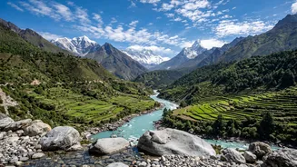
On the morning of August 26, 2026, a catastrophic event unfolded that was far from a typical monsoon downpour. Scientists believe a large mass of ice and rock collapsed from a glacier near the Nepal-Tibet border. This triggered a powerful surge of water,
mud, and debris down the Bhote Koshi and Trishuli river corridors, wiping out homes, bridges, and critical infrastructure in its path. The disaster struck with the force equivalent to a 5.2-magnitude earthquake, catching communities and travellers by surprise. The worst-hit areas include the districts of Rasuwa, Nuwakot, and Dhading, north of Kathmandu.
Which Areas Are Affected (and Unaffected)?
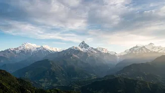
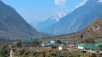
It is crucial for travellers to understand that this disaster is geographically concentrated and has not impacted the entire country. The primary damage is along the northern river corridors flowing from the Tibet border. The Rasuwa district, home to the popular Langtang trekking region and the main overland route to Tibet (Rasuwagadhi/Kerung), is the most severely affected area and is not recommended for travel. The destruction has washed away entire sections of roads and key bridges, making access impossible for the foreseeable future. Downstream areas in Nuwakot and Dhading districts have also sustained significant damage. However, many of Nepal's premier tourism hubs are entirely unaffected. The Everest (Khumbu) and Annapurna regions remain fully operational for trekking. Major cities like Kathmandu and Pokhara, as well as Chitwan National Park, are safe and continue to welcome visitors as usual. Kathmandu's Tribhuvan International Airport remains open for both domestic and international flights.
Impact on Trekking and Travel Routes
For those planning an autumn trek, the key is to know which routes are viable. The Langtang Valley, Ganesh Himal, and Gosaikunda treks are currently inaccessible due to the destruction of the main approach road through Syabrubesi. Similarly, the overland route to Mount Kailash in Tibet via Kerung is closed. In positive news for trekkers, the most popular circuits, including Everest Base Camp and the Annapurna Circuit, were not in the flood's path and are open. Even routes that experienced monsoon-related road damage earlier in the season, such as the approach to the Annapurna Base Camp, have reportedly been repaired and reopened. The Nepal Tourism Board has established an information desk to provide updates for tourists, highlighting that while a specific part of the country is in crisis, Nepal remains open for tourism in unaffected areas.
Essential Precautions for Travellers
If you have an upcoming trip to Nepal, flexibility and thorough planning are paramount. Do not rely solely on old information; conditions can change rapidly. First, contact your airline and tour operator for the latest updates on your itinerary. If you plan to trek, communicate directly with your guide or trekking agency to confirm that your intended route is safe and accessible. Travel insurance that includes medical evacuation is non-negotiable, as medical facilities are limited, particularly in remote areas. Even in unaffected regions, the monsoon season, which can last into early October, still poses risks of landslides and localized flooding. Avoid travelling near major river systems, monitor local weather reports, and always follow the advice of local authorities. Both the UK and US governments have issued advisories urging citizens to exercise increased caution and stay informed.