







ISRO’s Eyes on the Ocean
The OceanSat series of satellites are ISRO's dedicated observers for our oceans. The latest in this line, formally known as EOS-06 or OceanSat-3, was launched in November 2022. Circling the Earth in a polar orbit, its mission is to provide continuous
data for oceanographic and atmospheric studies. Among its sophisticated instruments are a scatterometer to measure wind speed and a Sea Surface Temperature Monitor. But its most unique tool is the Ocean Colour Monitor (OCM-3), a highly advanced 13-band camera that forms the backbone of this weather-tracking capability. This instrument is a significant upgrade from previous versions, offering greater detail and accuracy.
Decoding the Ocean’s Hues
When we think of ocean colour, we imagine shades of blue and green. But for an OceanSat satellite, colour is a rich stream of data. The Ocean Colour Monitor doesn't just see colour; it measures the specific wavelengths of light reflecting off the ocean's surface. The key to this entire process lies in microscopic marine plants called phytoplankton. These tiny organisms contain chlorophyll, the same pigment that makes plants on land green. By measuring the concentration of chlorophyll, the OCM can map the abundance of phytoplankton in the water with remarkable precision. Different shades and spectral signatures reveal not only phytoplankton but also suspended sediments and other organic matter, providing a complete picture of the upper ocean's composition.
The Link Between Marine Life and Cyclones
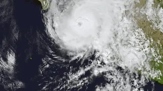
The connection between microscopic plants and powerful cyclones is fascinating. Cyclones and other intense weather fronts are powerful engines of energy. As they move across the sea, their strong winds churn the ocean violently. This process, known as upwelling, drags nutrient-rich cold water from the deep sea to the surface. For the phytoplankton floating in the sunlit upper layers, this sudden influx of nutrients is a feast. It triggers massive growth spurts, creating large-scale 'blooms' that can be vast in size. A satellite like OceanSat-3 can easily detect these blooms by the sudden, dramatic increase in chlorophyll concentration. The size, shape, and movement of these blooms provide scientists with crucial clues about the storm that created them.
From Algae Blooms to Weather Alerts
By tracking these phytoplankton blooms, ISRO scientists can effectively trace the path of a cyclone. The trail of high chlorophyll concentration acts like a footprint, showing where the storm has been and the intensity of its churn. This data, when combined with other observations like sea surface temperature and wind vector data from the satellite's scatterometer, creates a much more detailed and reliable forecast. For instance, a drop in sea surface temperature combined with a spike in chlorophyll is a strong indicator of a cyclone's wake. This information is vital for predicting a cyclone's trajectory, its potential for intensification, and where it might make landfall, giving disaster management agencies crucial lead time to prepare and save lives.
More Than Just Storm Tracking
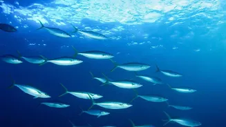
The applications for ocean colour data extend far beyond cyclone warnings. This information is invaluable for India's massive fishing community. Since phytoplankton form the base of the marine food web, mapping their location helps identify Potential Fishing Zones (PFZs), making fishing more efficient and sustainable. Furthermore, the data helps in monitoring coastal water quality, tracking sediment movement which is important for port management, and studying the long-term impacts of climate change on ocean biology. It provides a comprehensive health report of our oceans, from biological productivity to pollution events, making the OceanSat program a multi-purpose tool for national development.