




What is Monsoon Withdrawal?
Monsoon withdrawal isn't like flipping a switch; it's a gradual and complex meteorological process. The India Meteorological Department (IMD) formally declares withdrawal based on specific criteria. For a withdrawal to be announced, there must be a cessation
of rainfall for five consecutive days, a significant drop in moisture in the atmosphere, and the establishment of an anti-cyclonic circulation in the lower atmosphere. This anti-cyclone effectively pushes the moisture-laden monsoon winds away, allowing drier conditions to set in. The entire process begins in the northwestern part of the country and slowly makes its way southeast over several weeks.
The Starting Line: When and Where It Begins
The retreat of the monsoon has a well-defined starting point. It typically commences from the extreme northwestern parts of India, specifically over West Rajasthan. In 2020, the IMD revised the normal start date for this withdrawal to September 17. However, this date is an average, and the actual onset of withdrawal can vary. In recent years, there has been a trend of delayed withdrawal. For more than a decade, the monsoon has often lingered longer than its historical average, sometimes beginning its retreat only in late September or even early October.
The Forecast for September 2026
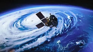
As of early September 2026, satellite imagery shows significantly clearer skies over large parts of India, particularly in the northwest and central regions. While this indicates a weakening of monsoon activity, the IMD has not yet officially declared the start of the withdrawal. Weather models from agencies like the European Centre for Medium-Range Weather Forecasts (ECMWF) predict that conditions will become increasingly favourable for a retreat in the second half of the month. These models suggest that a 'monsoon withdrawal anticyclone' is likely to strengthen over northwest India, possibly maturing around September 21, which would set the stage for an organised retreat. Earlier in the year, some forecasts, influenced by developing El Niño conditions, suggested a potentially early withdrawal.
The Domino Effect Across the Country
The withdrawal is a slow-moving domino effect. After starting in the northwest around mid-September, the line of withdrawal progresses southeastwards. It typically leaves most of the country, except for the southern peninsula, by mid-October. The entire process concludes when it finally withdraws from the extreme southern tip of the peninsula around December. This staggered retreat means that on the same day in late September, Delhi might be experiencing dry, post-monsoon weather while Kerala could still be receiving monsoon rains. This lengthy process contrasts with the more rapid advance of the monsoon during its onset.
Beware the 'October Heat'
As the monsoon clouds disappear, they are often replaced by a phenomenon known as the 'October Heat'. This period is marked by clear skies and a rise in temperatures. However, the land is still moist from the months of rain, leading to high humidity. The combination of high heat and high humidity creates an oppressive and uncomfortable weather condition, which can feel more stifling than the dry heat of summer. This phase is most pronounced in northern and central India before the cooler, drier winter air begins to set in by mid-November.
The Next Chapter: Northeast Monsoon
The withdrawal of the southwest monsoon sets the stage for the next phase of India's rain calendar: the northeast monsoon. As the wind patterns reverse, blowing from the northeast, they pick up moisture over the Bay of Bengal. These winds then bring significant rainfall to the southeastern coast, particularly Tamil Nadu, Rayalaseema, and parts of Kerala and Andhra Pradesh. For these regions, October and November are often the rainiest months of the year, in a system often referred to as the 'winter monsoon'.