

A Landmark Mission Takes Flight
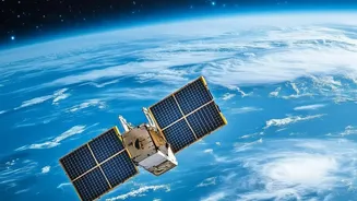
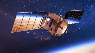
The NASA-ISRO Synthetic Aperture Radar (NISAR) is a landmark collaboration between the two space agencies, representing one of the most sophisticated Earth observation satellites ever built. Launched in mid-2025, its primary goal is to provide exquisitely
detailed measurements of changes in Earth’s surface.. What makes NISAR special is its use of two different radar frequencies, L-band and S-band, allowing it to systematically map our planet with stunning precision.. This dual-frequency capability will enable scientists to track changes in ecosystems, ice sheets, and the ground itself, sometimes down to the centimetre.. The mission is designed to monitor the entire globe every 12 days, creating a consistent and reliable stream of information vital for understanding our changing world.
Seeing Through Clouds and Darkness
Unlike traditional optical satellites that function like cameras and are often hindered by clouds or the dark of night, NISAR uses Synthetic Aperture Radar (SAR). SAR is an active sensing technology, meaning the satellite sends down its own microwave signals and measures the echoes that bounce back. This allows it to “see” the Earth’s surface regardless of weather or time of day.. This is a game-changer for a country like India, where monsoon clouds can obscure vast regions for months. The L-band radar, with its longer wavelength, can even penetrate through forest canopies to measure the structure and biomass below, while the S-band is adept at monitoring agricultural areas and vegetation.. This all-weather, 24/7 monitoring is critical for timely disaster management and tracking rapid environmental changes.
Data to Train a Generation
In a strategic move, both NASA and ISRO have begun releasing provisional data products well into the mission's operational phase.. ISRO is making S-band data available through its Bhoonidhi portal, while NASA's Alaska Satellite Facility is distributing the L-band data.. This release of provisional and sample data is not just a technical milestone; it's a massive educational initiative.. The goal is to give scientists, researchers, and students a head start. By working with this data now, they can develop the necessary tools, algorithms, and analytical skills to be ready when the fully validated data streams become routine.. This approach ensures that the scientific community doesn't have to play catch-up, but can instead hit the ground running, maximising the mission's impact from day one.
India’s New Climate Watchtower
For India, NISAR’s data has profound implications for tackling climate change. The satellite's precision will allow for unprecedented monitoring of Himalayan glaciers, providing clear data on their retreat and the subsequent impact on water resources for millions.. In agriculture, the ability to measure soil moisture will be invaluable for crop management and forecasting, enhancing food security.. Furthermore, NISAR will be able to detect land subsidence in urban areas—the slow sinking of ground—which is a growing concern for many Indian cities. It will also help in accurately mapping deforestation, tracking changes in mangrove forests along the coast, and understanding the carbon cycle on a national scale.. This data empowers policymakers with the concrete evidence needed to craft effective climate adaptation and mitigation strategies.
Beyond Climate: A National Asset
While the focus is heavily on climate, NISAR's applications extend far beyond. The mission is a powerful tool for disaster management, capable of mapping the extent of flooding even under heavy cloud cover and identifying areas at risk of landslides.. It will also provide crucial information for managing natural resources, monitoring infrastructure, and even understanding the aftermath of earthquakes and volcanic activity.. By participating in and co-leading this mission, India has solidified its position at the forefront of space-based Earth sciences. The open data policy ensures that this national asset will benefit not just government agencies but also startups, academic institutions, and innovators across the country, fostering a vibrant ecosystem of geospatial data analysis.