






A Landscape of Constant Peril
The Indian Sundarbans, a sprawling archipelago of low-lying islands, is a region of breathtaking beauty and immense vulnerability. Home to around 4.5 million people, this delta is on the front line of climate change. Sea levels here are rising faster
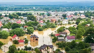
than the global average, swallowing land that has been inhabited for generations. The increasing frequency and intensity of cyclones, such as the devastating Amphan in 2020, bring catastrophic storm surges that breach embankments, flood villages with saline water, and destroy homes and livelihoods in a matter of hours. Studies show that communities in the region face a cyclone roughly every 17 months, with the vast majority of households experiencing damage to their homes and crops. This relentless cycle of disaster leaves little time for recovery, trapping communities in a state of chronic vulnerability.
The Digital Shield: What is Telemetry?
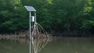
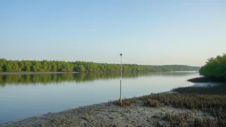
In this high-stakes environment, information is the most valuable currency. This is where real-time telemetry systems come in. In simple terms, telemetry is the automated process of collecting data from remote or inaccessible points and transmitting it to a central location for monitoring and analysis. Think of it as a digital nervous system for the environment. These systems use a network of sensors to measure critical parameters like river water levels, wind speed, atmospheric pressure, and even seismic activity. This data is then sent instantly, via wireless signals or satellite, to a control centre. It's a crucial departure from older methods that relied on manual observations, which were often too slow and dangerous to perform during an impending disaster.
From Raw Data to Life-Saving Action
Collecting data is only the first step; its true power lies in its rapid interpretation and dissemination. Agencies like the Indian National Centre for Ocean Information Services (INCOIS) and the India Meteorological Department (IMD) operate as the nerve centre of this operation. When sensors detect a dangerous surge in water levels or the formation of a cyclone, powerful computer models are used to predict its path and potential impact within minutes. This triggers a multi-channel alert cascade. Warnings are broadcast not just to disaster management authorities, but directly to the people in harm's way. This “last-mile connectivity” is achieved through a combination of sirens, public address systems, and increasingly, targeted SMS alerts sent directly to mobile phones in the threatened areas. This gives communities precious hours, or even days, to act.
Minutes that Make a Difference
For the residents of the Sundarbans, this lead time is the difference between life and death. It allows families to secure their belongings, reinforce their homes, and move livestock to safer ground. Most importantly, it provides the critical window needed to evacuate to cyclone shelters. The success of India’s early warning systems has been credited with drastically reducing the loss of life in recent cyclones. After the devastating 1999 Odisha super cyclone, India invested heavily in this technology, and the results are stark. Modern systems can provide impact-based, location-specific warnings with 30% greater accuracy, significantly reducing evacuation costs and, more importantly, saving countless lives. These warnings empower communities to transform from passive victims into active participants in their own safety.
Challenges and the Road Ahead
Despite their success, these systems are not a magic bullet. The harsh, saline environment of the Sundarbans makes maintaining sensitive electronic equipment a constant challenge. Ensuring uninterrupted power supply and robust connectivity across remote islands requires continuous investment and innovation. Furthermore, the technology must be paired with community education and preparedness drills to be truly effective. Authorities recognize the need to integrate high-tech solutions like Artificial Intelligence (AI) and Geographic Information Systems (GIS) with local knowledge. The goal is to create a dynamic, multi-hazard warning system that is not only faster and more accurate but also deeply embedded within the community it serves.