






A Partnership for the Planet
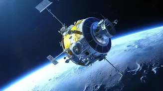
The NASA-ISRO Synthetic Aperture Radar (NISAR) mission is a powerful symbol of international collaboration in space. Jointly developed by the U.S. space agency and its Indian counterpart, this sophisticated Earth observation satellite marks the first
time the two nations have partnered on such a project. Launched on July 30, 2025, aboard an Indian GSLV rocket, the mission combines the strengths of both agencies: NASA provided the L-band radar, a high-rate communication subsystem, and GPS receivers, while ISRO contributed the S-band radar, the spacecraft bus, and the launch vehicle. This ambitious collaboration has resulted in what is likely the world's most expensive Earth-imaging satellite, a testament to its advanced capabilities and the critical nature of its mission. The data it gathers is open and freely available, designed to benefit the entire global scientific community.
Seeing the Unseen with Dual-Frequency Radar
What makes NISAR so special is its technology. It is the first satellite to use two different radar frequencies (L-band and S-band) to observe the Earth. This dual-frequency Synthetic Aperture Radar (SAR) can penetrate clouds and operate day or night, providing an uninterrupted stream of high-resolution images. Think of it as having X-ray vision for the planet. While the L-band radar can see through dense vegetation to monitor changes in forests, the S-band is ideal for tracking surface changes and soil moisture. Together, they can detect tiny movements on the Earth's surface—as small as a centimetre. The satellite scans nearly the entire globe every 12 days, creating an incredibly detailed and consistent time-lapse of our planet's land and ice.
A Game-Changer for India's Disaster Management
For India, NISAR's data is a potential game-changer. The satellite provides crucial insights for managing natural disasters to which the country is particularly vulnerable. Its ability to monitor ground deformation can provide early warnings for earthquakes and landslides, especially in the fragile Himalayan region. The satellite’s all-weather capabilities are vital for tracking floods during monsoon season and monitoring cyclones along India's extensive coastline. This near real-time information will empower authorities to make faster, more informed decisions, helping to mitigate damage and save lives. ISRO has specifically identified disaster monitoring as a key application for the mission, alongside studying Himalayan glaciers and coastal processes.
Fueling Agriculture and Climate Action
Beyond disasters, NISAR’s observations have profound implications for India’s agricultural sector and climate resilience. The satellite's data helps in monitoring crop health, assessing biomass, and managing water resources more efficiently, which directly supports the nation's food security objectives. Farmers and policymakers can use this information for better crop yield predictions and sustainable farming practices. On the climate front, NISAR provides unprecedented detail on the melting of ice sheets and glaciers, the dynamics of forests and wetlands, and the overall impact of a warming planet. This torrent of data will help scientists refine climate models and equip communities to better adapt to environmental changes.
The Soaring Economic Value of Data from Space
The growing value of Earth observation (EO) data is not just scientific; it's economic. The Indian EO market is projected to grow significantly, reaching an estimated USD 379.1 million by 2030, driven by surging demand across various sectors. Data from satellites like NISAR is a valuable commodity that can de-risk investments in agriculture, guide urban planning, and inform the insurance and finance industries. By providing precise information on everything from infrastructure stability to resource availability, EO data enhances efficiency and drives innovation. As Indian space startups increasingly enter the global market, missions like NISAR reinforce the country's position as a major player in the burgeoning space economy.








