


An All-Weather Eye on Earth
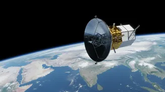
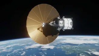
NISAR is a joint Earth-observing mission between NASA and the Indian Space Research Organisation (ISRO), representing a major collaboration in space science. It is the first satellite to use two different radar frequencies (L-band and S-band), which allows
it to systematically map our planet with unprecedented detail. Orbiting at an altitude of 747 km, NISAR circles the globe every 12 days, gathering a steady stream of information. Its most significant advantage is its use of Synthetic Aperture Radar (SAR), a technology that can see through clouds, rain, and darkness. Unlike optical satellites that need clear daylight, NISAR provides reliable, all-weather, day-and-night imaging of Earth's surface.
Data for the People
In a landmark move for science, both NASA and ISRO have committed to a free and open data policy for the NISAR mission. As of July 2026, processed S-band data from ISRO and L-band data from NASA have been made publicly available. ISRO provides access to its datasets via the Bhoonidhi online portal, while NASA uses its Earthdata Cloud. This decision breaks from older models where high-resolution satellite imagery was often expensive or restricted to a small group of researchers. By making these terabytes of information accessible to anyone with an internet connection, the mission democratizes Earth observation science. Researchers, government agencies, and the general public can now download and analyse this cutting-edge data.
From Satellite to Classroom
The true transformative power of this open data policy lies in its potential for education. University and even school students can now design projects using the same high-quality data as leading scientists. This brings complex environmental science out of the textbook and into the real world. For example, a group of students in a coastal state could download SAR images to monitor shoreline changes or mangrove health over time. Another project could involve tracking urban sprawl around their city or analysing soil moisture levels in local agricultural areas to understand irrigation patterns. ISRO has actively encouraged this through initiatives like the NISAR Utilization Programme (NISAR UP), which invites project proposals from Indian researchers and academic institutions to leverage this new data source.
Tackling India's Biggest Challenges
The applications for NISAR data are directly relevant to some of India’s most pressing national challenges. The S-band radar, provided by ISRO, is particularly well-suited for monitoring crop health and biomass, which is vital for the nation's food security. The data will also be invaluable for disaster management. By comparing images taken before and after an event, authorities can quickly map the extent of flooding, identify areas at risk of landslides, or assess earthquake damage, even when cloud cover obstructs other satellites. Furthermore, the mission will monitor the Himalayan glaciers, providing crucial information on snow and ice melt that affects water resources for millions. Student projects in these areas serve as a crucial training ground, preparing a new generation to tackle these complex environmental issues.