







Nature's First Line of Defence
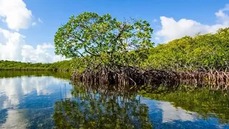
The Sundarbans, the world's largest mangrove forest, is more than just a UNESCO World Heritage site teeming with biodiversity; it is a critical protective barrier for millions of people in West Bengal. For generations, its dense network of mangrove trees
has stood guard, their tangled, robust root systems acting like a natural anchor, holding soil in place and preventing the sea from swallowing the land. These unique forests thrive in the harsh, saline environment of the coastal intertidal zone, dissipating wave energy from storms and cyclones that frequently brew in the Bay of Bengal. This natural defence significantly reduces the impact of storm surges, protecting homes, agricultural lands, and lives in one of the world's most vulnerable deltas.
A Disappearing, Shifting Coastline
Despite this natural protection, the Sundarbans is facing an existential threat. The coastline is in constant flux, with some areas eroding at alarming rates. One study estimated that the Indian Sundarbans lost approximately 110 square kilometres of mangroves to erosion between 2000 and 2020. The causes are a combination of powerful natural forces and human pressures. Sea-level rise in this region is occurring at a rate faster than the global average, compounding the effects of land subsidence. This makes the coast more susceptible to the battering of frequent, intense cyclones. Traditionally, measuring the precise rate of erosion across such a vast and inaccessible landscape was a monumental task, often relying on costly and limited ground surveys.
Eyes in the Sky: A New Perspective
This is where advanced satellite analytics come in. Using data from satellites like the Landsat and Sentinel series, scientists can now monitor the entire Sundarbans coastline systematically and over long periods. These “eyes in the sky” provide a wealth of information that is impossible to gather from the ground. By capturing images across different spectral bands, satellites can distinguish between land and water with incredible precision. Using techniques to analyse the Normalised Difference Vegetation Index (NDVI), researchers can also assess the health and density of the mangrove forests themselves over decades. This creates a historical, data-rich picture of the changing landscape.
How Data Becomes Defence
The process of quantifying the mangroves' defensive role is a powerful example of data science in action. Scientists use automated algorithms and machine learning to analyse thousands of satellite images, some stretching back decades. They extract the exact land-water boundary from each image and apply corrections for tidal variations to ensure accuracy. By comparing these shorelines over time, they can calculate the rate of erosion or accretion (land gain) in meters per year for every part of the coast. The crucial next step is to correlate these findings with data on mangrove cover. The analysis consistently shows that coastlines buffered by wide, dense mangrove forests are significantly more stable and experience far less erosion than unprotected areas.
From Numbers to Meaningful Action
Putting a precise number on the value of mangroves transforms conservation from a hopeful wish into a data-driven strategy. This quantification allows policymakers and environmental managers to identify erosion hotspots and prioritise resources for mangrove restoration and protection. For example, a study could show that a 100-metre-wide belt of healthy mangroves reduces wave energy by a specific, measurable percentage, providing a clear justification for investment. This data can inform where to build embankments, where to focus community-led plantation drives, and how to better plan for the safety of coastal villages. It proves, in the clear language of numbers, that protecting and restoring these natural ecosystems is one of the most cost-effective ways to secure the future of the Sundarbans.