


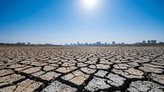


The Usual Suspect: El Niño's Classic Impact
El Niño is a climate pattern defined by the unusual warming of surface waters in the central and eastern equatorial Pacific Ocean. This oceanic shift has a domino effect on global weather. For India, it typically weakens the monsoon. The warmer Pacific waters alter
the Walker Circulation, a crucial atmospheric system, which can lead to suppressed rainfall over the Indian subcontinent. Historically, many of India's most severe droughts have coincided with strong El Niño events, solidifying this connection in the public consciousness. This inverse relationship—a warmer Pacific often meaning a drier India—is the baseline for long-range monsoon forecasts.
The Counterforce: The Indian Ocean Dipole
The monsoon's fate is not decided by the Pacific Ocean alone. A closer neighbor, the Indian Ocean Dipole (IOD), plays a critical role. The IOD refers to the difference in sea-surface temperatures between the western Indian Ocean (near the Arabian Sea) and the eastern Indian Ocean. A 'positive' IOD, with warmer waters in the west and cooler in the east, can be a saving grace for India. These warmer western waters boost moisture-laden winds heading towards India, strengthening the monsoon. A strong positive IOD can often counteract the negative effects of an El Niño, leading to near-normal or even good rainfall, as seen in some past El Niño years like 1997-98. Conversely, a 'negative' IOD can worsen an El Niño's drying effect.
Not All El Niños Are Created Equal
Recent climate science has revealed that the location of the Pacific warming matters immensely. The 'classic' or Canonical El Niño involves warming in the eastern Pacific, near South America. However, another variant, known as 'El Niño Modoki' (Japanese for 'similar, but different'), is characterized by warming in the central Pacific. The impact of these two types on India can be quite different. Studies suggest that an El Niño Modoki, with its warming centered farther west, can have a more pronounced drying effect on India than a classic El Niño. Understanding which type of El Niño is developing is therefore crucial for accurate monsoon prediction.
The Wild Card: Madden-Julian Oscillation
Adding another layer of complexity is the Madden-Julian Oscillation (MJO). The MJO is a massive, eastward-moving pulse of cloud and rainfall that travels around the equator, typically on a 30 to 60-day cycle. Unlike El Niño or the IOD, which are seasonal patterns, the MJO is an intra-seasonal force that can either enhance or suppress rainfall on a shorter timescale. If an active phase of the MJO passes over the Indian Ocean during the monsoon, it can bring a surge of heavy rainfall, temporarily overriding the larger background signals from El Niño. A weak or suppressed MJO phase, however, can contribute to the long 'breaks' or dry spells within the monsoon season. Its timing and strength can make or break rainfall totals for a given month.
A Symphony of Factors
Ultimately, the Indian monsoon is a vast and intricate system, a result of a complex interplay of global and regional phenomena. El Niño is just one influential player in a much larger orchestra. The Indian Ocean Dipole acts as a powerful counterbalance, while the type of El Niño and the unpredictable timing of the MJO add further variability. Other factors, such as snow cover over the Himalayas and Eurasia and local aerosol content, also contribute to the monsoon's performance. This is why meteorologists often speak in terms of probabilities; predicting the monsoon is about weighing the influence of all these competing factors to determine which will dominate.