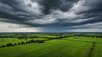


What Exactly Is a Cyclonic Circulation?
Before you picture a massive, swirling storm with an eye, it’s important to clarify: a cyclonic circulation is not the same as a cyclone. Think of it as a cyclone's less intense cousin. It is a large-scale system of winds rotating cyclonically (counter-clockwise
in the Northern Hemisphere) around a central area of low atmospheric pressure. While it lacks the destructive wind speeds of a named cyclone, its primary function is to gather and lift vast amounts of moisture. This particular system formed over the northeast Arabian Sea and adjoining coastal areas of Gujarat, creating the perfect engine for pulling in moisture-laden air from the warm sea.
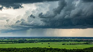
The Moisture Pump to Central India
This weather system is acting like a giant, atmospheric pump. The low-pressure core of the circulation creates a vacuum effect, drawing in humid winds from the Arabian Sea. As these winds move over land, they are forced to rise. When moist air rises, it cools, and the water vapour within it condenses to form clouds, eventually leading to heavy rainfall. The system's position is crucial; it's perfectly placed to channel a continuous stream of moisture directly into the heart of the country, turning the skies dark over states hundreds of kilometres from the coast.
Which Regions Are on Alert?
The India Meteorological Department (IMD) has been tracking this system closely and has issued alerts for several states. The primary impact zone is central India. Madhya Pradesh is bearing a significant brunt of the rainfall, with many districts on orange or yellow alert for heavy to very heavy showers. The Vidarbha region of Maharashtra, along with parts of Marathwada, is also experiencing intense spells of rain. Eastern Gujarat and southeastern Rajasthan are on the periphery of this system, receiving moderate to heavy rainfall as well. These rains have led to waterlogging in urban areas and have raised concerns about river levels and the condition of standing crops.
A Complex Interaction of Weather Systems
This event isn't happening in isolation. The intensity of the rainfall is being amplified by the interaction of this cyclonic circulation with other prevailing weather patterns. The monsoon trough, a semi-permanent low-pressure line that typically extends from northwest India to the Bay of Bengal, is currently active and positioned favourably to interact with the moisture feed from the Arabian Sea system. This synergy between the two systems is what elevates a standard rain event into a prolonged period of heavy and widespread precipitation, making it more impactful than if the circulation were acting alone.
What to Expect in the Coming Days
According to weather models, this cyclonic circulation is expected to persist for another 48 to 72 hours, though its intensity might gradually decrease as it moves further inland and gets cut off from its primary moisture source, the Arabian Sea. This means that central India can expect continued rainfall, albeit with decreasing intensity over the next few days. Residents in the affected areas are advised to stay updated with IMD forecasts, avoid waterlogged streets, and take necessary precautions against lightning and strong gusty winds that can accompany these heavy spells. For farmers, while the rain can be beneficial for soil moisture, excessive downpours pose a risk to mature Kharif crops ready for harvest.