



A Groundbreaking Partnership in Orbit
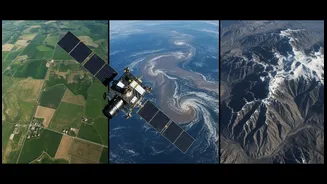
NISAR, which stands for NASA-ISRO Synthetic Aperture Radar, is a sophisticated Earth observation satellite. Born from a landmark collaboration formalized in 2014, it represents one of the most significant joint space projects between the United States
and India. The mission is ambitious: to map the entire globe every 12 days, providing an unprecedented and detailed view of our planet's land and ice surfaces. With an estimated cost of $1.5 billion, it is considered the world's most expensive Earth-imaging satellite. Launched from the Satish Dhawan Space Centre, the satellite now orbits 747 kilometres above the Earth, ready to begin its five-year mission to observe and measure some of the planet's most complex processes.
Seeing Through the Storm
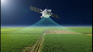
What makes NISAR truly special is its advanced radar technology. Unlike standard optical satellites that are blinded by clouds or darkness, NISAR uses Synthetic Aperture Radar (SAR), which can see through almost any weather conditions, day or night. This is a critical capability during extreme weather events like monsoonal flooding or cyclones, when immediate and clear information is most needed. The satellite is uniquely equipped with two different radar frequencies: an L-band provided by NASA and an S-band developed by ISRO. This dual-frequency approach allows it to capture a wider range of data; the L-band can penetrate forest canopies and soil to measure things like ground moisture and biomass, while the S-band excels at monitoring finer surface details, vegetation, and infrastructure.
Transforming Disaster Response
For India, a nation frequently impacted by natural disasters, NISAR’s applications are profound. The satellite’s ability to detect surface changes as small as a centimetre makes it a powerful tool for hazard management. During floods, its radar can map the extent of inundation, even in densely vegetated areas like the Sundarbans, providing critical information for rescue and relief operations. For landslides, a constant threat in the Himalayas and Western Ghats, NISAR can monitor ground deformation to identify unstable slopes before they collapse and assess damage after an event. The data will also be invaluable for monitoring earthquakes by tracking crustal deformation, which can help in identifying areas under tectonic stress. In emergencies, data can be made available within hours, giving disaster management agencies a vital head start.
Beyond Disasters: A Tool for a Changing Climate
NISAR's utility extends far beyond immediate disaster response. Its data will provide crucial insights for understanding and adapting to long-term climate change. The mission will track the melting of Himalayan glaciers, a critical water source for millions, and monitor sea-level changes along India's extensive coastline. For agriculture, the satellite can monitor crop health, soil moisture, and assess damage after storms, aiding in food security planning. Furthermore, it can detect slow-moving changes like land subsidence in urban areas, a growing concern for many Indian cities. By creating a consistent, long-term record of our changing environment, NISAR will empower scientists and policymakers to make more informed decisions about water management, urban planning, and environmental protection.