




What is El Niño?
At its heart, El Niño is a climate pattern involving the unusual warming of surface waters in the eastern and central Pacific Ocean. This isn't just a local event; it sets off a chain reaction, disrupting atmospheric circulation and weather patterns across
the globe. Normally, strong trade winds blow from east to west across the Pacific, piling up warm water in Asia. During an El Niño, which occurs every two to seven years, these winds weaken or even reverse. This shift changes air pressure and rainfall patterns, often leading to reduced rainfall over areas like Indonesia, Australia, and, crucially, India.
The Classic Monsoon Connection
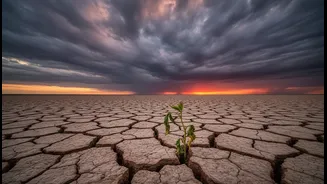
For India, El Niño has historically been the villain of the monsoon story. The health of the Indian summer monsoon, which provides about 70% of the country's annual rainfall, is deeply connected to these global patterns. A strong El Niño typically weakens the monsoon circulation, suppresses rainfall, and increases the likelihood of drought. Historically, about half of all El Niño years have coincided with monsoon droughts in India, making it a primary concern for agriculture, water resources, and the economy. The impacts go beyond just a lack of rain, often leading to delayed monsoon onset and more frequent, intense heatwaves.
A Tale of Two Indias
However, El Niño's impact is not uniform across the vast Indian subcontinent. Recent studies reveal a fascinating and evolving relationship. The link between El Niño and monsoon rainfall has become exceptionally strong for North India, while it has surprisingly weakened over Central India, the traditional core monsoon zone. For South India, the relationship has remained more stable. This regional disparity means that during an El Niño year, North India is increasingly vulnerable to its effects, while the impact on the central region has become less predictable. Furthermore, even during a generally dry El Niño year, some regions like central India and the Western Ghats can experience an increase in intense, extreme rainfall events, creating a paradoxical situation of overall drought punctuated by devastating downpours.
The Indian Ocean's Own Story
A crucial reason for these varied responses is another major climate player: the Indian Ocean Dipole (IOD), sometimes called the Indian Ocean's own El Niño. The IOD refers to the temperature difference between the western and eastern parts of the Indian Ocean. It has three phases: positive, negative, and neutral. A 'positive' IOD, with warmer waters in the western Indian Ocean (the Arabian Sea), can be a saving grace for India. It pushes more moisture towards the Indian subcontinent, potentially counteracting El Niño's drying effect and boosting monsoon rains, particularly in the latter half of the season. The strong positive IOD in 1997, for example, helped India achieve an above-normal monsoon despite one of the strongest El Niños on record. Conversely, a 'negative' IOD can worsen El Niño's impact, leading to severe drought.
Local Factors and Shifting Patterns
India's own geography plays a significant role in modifying climate influences. The towering Himalayas act as a massive barrier, preventing cold northern winds from entering and shaping monsoon patterns. The Western Ghats influence rainfall on the peninsula, while the vast Thar Desert creates its own thermal dynamics. Complicating matters further is the overarching reality of climate change. Scientists note that global warming is altering the fundamental character of the monsoon. While El Niño might reduce the number of rainy days, climate change is making the rain that does fall more intense and concentrated into shorter, more extreme bursts. The warming of the Arabian Sea also means there is more moisture available to be dumped in these intense events.