


A Spectacle in the Skies
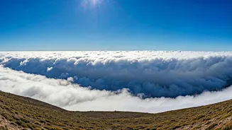
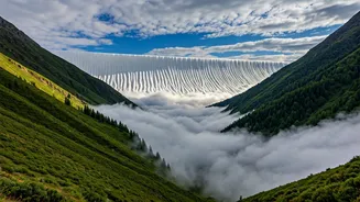
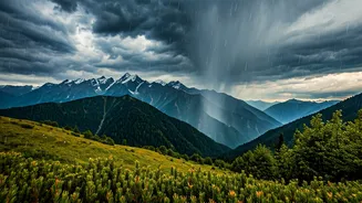
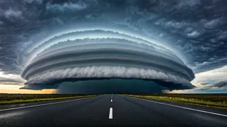
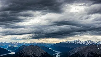
In recent weeks, social media feeds and local news outlets from regions like Uttarakhand and Himachal Pradesh have been flooded with astonishing images. They depict what looks like a solid, rolling tsunami in the sky—a vast, sharply defined cloud bank
that dwarfs the mountains below. Often tinged with ominous blues and greys, and sometimes catching the golden light of a late afternoon sun, these formations are known as cloud walls. They move with an unnerving speed, transforming a serene mountain landscape into a dramatic, almost theatrical scene in a matter of minutes. For onlookers, the experience is one of awe mixed with a primal sense of respect for nature's sheer scale. It’s a visual event that stops people in their tracks, compelling them to pull out their phones and capture the fleeting, formidable display.
The Science of the Wall
So, what exactly are these magnificent structures? Meteorologically, they are often a type of 'arcus cloud,' most commonly a 'shelf cloud.' This is not a storm itself, but rather the dramatic leading edge of a powerful thunderstorm system. Think of it as the bow wave of a ship, but for a storm. Its formation is a fascinating lesson in atmospheric dynamics. Inside a mature thunderstorm, strong downdrafts push cool, dense air down towards the ground. Upon hitting the surface, this air has nowhere to go but outwards, spreading rapidly like a cold blanket. This advancing mass of cool air is called a gust front. As the gust front pushes forward, it acts like a wedge, forcefully lifting the warmer, more humid air in its path. As this warm, moist air is rapidly lifted, it cools and condenses, forming the spectacular, layered 'wall' we see. The unique topography of the Himalayan valleys can further channel and accentuate this effect, making the formations appear even more structured and imposing.
More Than Just a Pretty Cloud
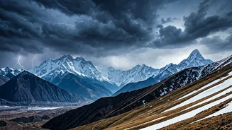
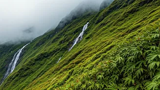
While visually stunning, a shelf cloud is a clear and immediate warning. It is the harbinger of severe weather. The arrival of the cloud wall itself is often accompanied by a sudden, sharp drop in temperature and a dramatic increase in wind speed as the gust front passes. What follows shortly after is the main body of the thunderstorm, which can unleash intense, localised downpours, hail, and dangerous lightning. For those in its path, the beauty of the cloud wall is a final, fleeting moment of calm before the storm’s fury is unleashed. These pre-monsoon thunderstorms, often called 'Kalbaisakhi' or 'Nor'westers' in other parts of India, are crucial for bringing early rains and cooling down the scorching summer temperatures, but their intensity demands caution. They are a potent reminder that the most beautiful natural phenomena are often linked to its most powerful forces.
A Photographer's Dream, A Local's Reality
The proliferation of these images online highlights a modern duality. For tourists, storm chasers, and photographers, the appearance of a shelf cloud is a golden opportunity—a chance to capture a rare and majestic weather event. The resulting photographs and time-lapses are undeniably captivating. However, for the residents of these mountain valleys, the reality is far more practical. The stunning wall of cloud signals a need to secure loose objects, bring livestock to shelter, and prepare for potential power outages. The intense rains that follow can trigger localised flash floods in narrow ravines and cause landslides, posing a real threat to infrastructure and agriculture. It is a stark reminder that while many can appreciate the storm from a safe distance through a screen, those living under its path experience its full, un-filtered impact.