




The Core Idea: What Is an IoT Network?
Before diving into flood detection, it helps to understand the technology behind it. The 'Internet of Things' (IoT) refers to a network of physical objects—in this case, sensors—that are embedded with technology allowing them to connect and exchange data
over the internet. Think of it as creating a digital nervous system for a city. Instead of relying only on broad weather forecasts, IoT allows officials to get hyper-local, real-time information directly from storm drains, rivers, and low-lying areas, enabling a much faster and more targeted response.
The Eyes on the Water: Smart Sensors
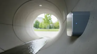
The foundation of any IoT flood network is the sensors. These are small, rugged devices strategically placed in critical locations. Water level sensors, often using ultrasonic technology, continuously measure the height of water in drains, canals, and riverbeds. They are complemented by other devices like rain gauges that measure precipitation intensity and even soil moisture sensors. These sensors act as 24/7 lookouts, collecting crucial data points that, individually, might not mean much, but together, paint a detailed picture of a developing flood situation.
From Sensor to Server: Real-Time Data Flow
Once a sensor detects a rising water level, it needs to send that information immediately. This is where low-power, long-range communication technologies come into play. The data is transmitted wirelessly to a central server or a cloud platform. This is not like a delayed weather report; the information is streamed continuously, allowing authorities to monitor conditions as they evolve minute by minute. This constant flow of data is what transforms the system from a simple monitoring tool into a proactive warning mechanism.
The Brains of the Operation: Data Analytics
A flood of data is useless without the ability to interpret it. The central platform receives information from hundreds of sensors and combines it with other critical data, such as weather forecasts, tide schedules, and the city's topography. Advanced systems use artificial intelligence and machine learning models to analyze this combined data. These models can identify patterns and predict where and when flooding is likely to occur, how deep the water might get, and which areas are most at risk. This predictive capability is the system's most powerful feature, turning raw data into actionable intelligence.
Sounding the Alarm in Indian Cities
The final, and most critical, step is warning the public and emergency responders. In India, several cities are already leveraging this technology. Mumbai’s Integrated Flood Warning System (IFLOWS) is a prime example. Developed by the Ministry of Earth Sciences in collaboration with the BMC, it aims to provide flood inundation estimates up to three days in advance and more immediate updates. These systems can trigger a variety of alerts, from SMS messages sent to residents in specific, at-risk wards to updates on web portals and mobile apps, and activating public address systems to guide evacuations. This allows for a targeted approach, ensuring the right people get the right warning at the right time.
Challenges on the Ground
Implementing these networks is not without its hurdles. High initial costs, the need for constant maintenance of sensors, and ensuring reliable network connectivity in all weather conditions are significant challenges. Data security and ensuring different systems and departments can work together seamlessly are also major considerations. Furthermore, for the system to be truly effective, the public must trust the alerts and know how to respond, which requires ongoing education and community engagement.