







The Birth of Cyclone Akvan
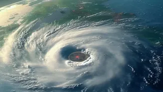
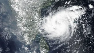
The story of Cyclone Akvan began not as a full-blown cyclone, but as a low-pressure area over the southeast Bay of Bengal. Around November 14, the India Meteorological Department (IMD) reported that this system had intensified into a well-marked low-pressure area and
was likely to become a depression within 24 hours. By the evening of November 16, it had gathered sufficient strength, intensifying from a deep depression into a cyclonic storm. At this point, it was officially named 'Akvan'. This confirmed that a cyclonic storm was indeed forming, moving from speculative social media chatter to an officially monitored weather event.
The Forecast for November 17
The headline's focus on November 17 was rooted in the IMD's own projections. In bulletins issued on November 15 and 16, the department forecast that Cyclone Akvan would likely intensify into a Severe Cyclonic Storm by the evening of November 17. Official IMD communications from November 17 itself reiterated this forecast, stating the system was very likely to strengthen into a Severe Cyclonic Storm over the west-central Bay of Bengal that evening. This wasn't misinformation; it was the official, science-based prediction from India's primary weather authority as the situation evolved.
Fact Check: Did It Intensify as Predicted?
Yes, the forecasts held true. On the morning of Wednesday, November 18, the IMD confirmed that Cyclone Akvan had indeed intensified into a Severe Cyclonic Storm over the central and adjoining west-central Bay of Bengal. The system had followed the predicted trajectory of intensification, validating the warnings issued in the preceding days. The focus then shifted to its next expected stage: further strengthening into a 'Very Severe Cyclonic Storm' by November 19, with a projected landfall along the Andhra Pradesh coast around noon on November 20.
Understanding the Name 'Akvan'
The name 'Akvan' is not random; it's part of a systematic process managed by the World Meteorological Organization (WMO) and regional bodies. For the North Indian Ocean region, which includes the Bay of Bengal and the Arabian Sea, 13 member countries contribute a list of names. 'Akvan' was a name contributed by Iran. The name itself has roots in Persian mythology, referring to a demon in the epic poem 'Shahnameh'. A storm system is assigned a name from this rotating list only after it intensifies into a cyclonic storm with specific sustained wind speeds, a threshold Akvan crossed on November 16.
The Projected Impact
With the storm's intensification confirmed, the IMD issued detailed warnings for coastal regions. The primary threat was directed at Andhra Pradesh, with the cyclone expected to make landfall between Nellore and Tuni as a Very Severe Cyclonic Storm. Warnings pointed to extremely heavy rainfall, powerful winds gusting up to 145 kmph, and a potential storm surge of 1 to 2 metres that could inundate low-lying coastal areas. Alerts were also extended to Odisha, Telangana, and Tamil Nadu for heavy rainfall. In response, fishermen were strongly advised to return to shore and suspend all fishing operations.
Relying on Official Sources
The case of Cyclone Akvan underscores the importance of sourcing weather information correctly. While social media can spread awareness, it can also create unnecessary panic or circulate outdated information. The IMD is the designated Regional Specialised Meteorological Centre for the North Indian Ocean. Its website, official press releases, and social media channels provide the most accurate, up-to-date tracking, intensity forecasts, and safety advisories. During an evolving weather event, relying on these official bulletins is crucial for public safety and preparedness, helping to distinguish between verified forecasts and speculative rumour.