


A Sharper Eye in the Sky
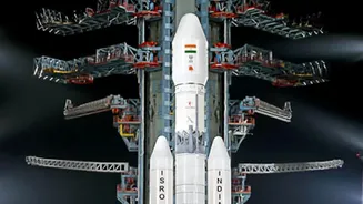
ISRO is enhancing its fleet of Earth observation satellites, including the OceanSat series, with powerful new radar sensors. While India has a sophisticated network of weather satellites like the INSAT series (including the recently launched INSAT-3DS)
that use infrared and optical sensors, the addition of advanced radar provides a crucial all-weather, day-and-night monitoring capability. These new sensors are part of a broader strategy to improve climate resilience and disaster management across the country. One of the key technologies being deployed is Synthetic Aperture Radar (SAR), a game-changer for weather observation.
How Advanced Radar Changes the Game
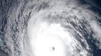
Traditional weather satellites often use optical or infrared sensors, which work like cameras. They capture images of cloud tops, which are incredibly useful. For instance, cold, bright white clouds in an infrared image often indicate tall, powerful storm systems capable of producing heavy rain. However, these sensors have a major limitation: they cannot see through thick cloud cover. This is like trying to see what’s on the ground from an aeroplane on a very cloudy day. Radar, specifically Synthetic Aperture Radar (SAR), solves this problem. It actively sends out microwave pulses that can penetrate clouds, dust, and darkness to map the surface and even measure wind speed over the oceans. This allows for a continuous, uninterrupted view of developing weather systems.
Peering Through the Monsoon Clouds
The ability to see through clouds is what makes these new radar sensors so vital for monsoon tracking. The monsoon season is, by definition, a period of extensive, thick cloud cover. Systems like the OceanSat-3's scatterometer (OSCAT-3), a type of radar, can measure wind vectors over the sea surface, which is where many monsoon depressions and cyclones are born. Another powerful tool is the joint NASA-ISRO satellite, NISAR, which uses dual-frequency radar to monitor changes on the Earth's surface, including soil moisture—a critical factor for agriculture and flood prediction. This technology pierces through the dense monsoon cloud banks to provide clear data, something that was previously a major challenge for forecasters.
From Satellite Data to Safer Communities
This enhanced data from space has a direct impact on the ground. ISRO provides a constant stream of information to the India Meteorological Department (IMD), which uses it to refine its weather models. More precise data on storm formation, intensity, and trajectory means more accurate and timely warnings for fishermen, coastal residents, and disaster response teams. For India’s farmers, who depend heavily on the monsoon, this technology is transformative. Better forecasts on rainfall patterns, enabled by satellites tracking soil moisture and weather systems, help in planning everything from sowing times to water management, boosting crop yields and reducing risks.
The Future of Weather Forecasting
The deployment of these advanced radar sensors marks a significant leap forward in India's scientific capabilities. By combining radar data from satellites like OceanSat and NISAR with the imagery from the geostationary INSAT series, scientists can build a much more comprehensive, three-dimensional picture of weather events. This synergy allows forecasters to not only see where storm systems are but to better understand their internal structure and potential. As these technologies become more integrated into our national weather infrastructure, they promise to make India more resilient in the face of an increasingly unpredictable climate, ensuring that the view from 36,000 kilometres above helps protect lives and livelihoods across the subcontinent.