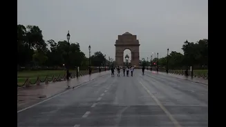


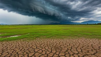


A Much-Needed Respite From the Heat
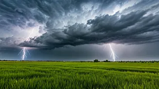
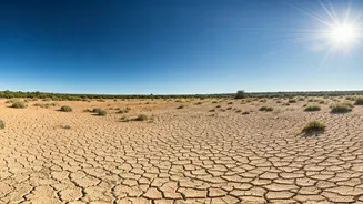
Residents across the Purvanchal region, from Gorakhpur to Varanasi and Prayagraj, are breathing a collective sigh of relief. The past few weeks have been grueling, with maximum temperatures consistently soaring, at times reaching as high as 43.2°C in Prayagraj and 42.5°C
in Varanasi. [26] An orange alert for severe heatwaves had been in effect for numerous districts. [26] However, the script has now flipped. The arrival of these easterly winds has ushered in cloud cover and scattered showers, leading to a noticeable drop in both day and night temperatures. [5, 7, 8] Forecasts for cities like Gorakhpur now predict thunderstorms and rain, with maximum temperatures expected to hover in the mid-to-high 30s instead of the blistering 40s. [5]
The Science Behind the 'Purvayi'
So, what exactly are these winds that have brought such a dramatic change? In local parlance, these easterly winds are known as 'Purvayi' or 'Purvaiya', literally meaning 'from the east'. [11, 15] These are not the dry, hot westerly winds ('Pachhua') that contribute to heatwaves. [11] Instead, the Purvayi winds originate from the Bay of Bengal, picking up significant moisture as they travel across the sea. [16, 19] As these moisture-laden winds move inland into the Gangetic plains, they bring humidity and, crucially, lead to cloud formation and precipitation. This process has a cooling effect, moderating the extreme heat that had built up over the region. [11, 12]
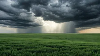
Harbinger of the Monsoon
The appearance of the Purvayi is more than just a temporary cool spell; it's a classic and eagerly awaited sign of the advancing Southwest Monsoon. [12, 16] The India Meteorological Department (IMD) has noted that conditions are becoming favorable for the monsoon's further advance into Uttar Pradesh. [10, 13] These easterly winds are a key component of the monsoon's circulation pattern in this region. As the monsoon trough shifts, it pulls these winds from the Bay of Bengal, paving the way for more widespread and sustained rainfall. [16, 19] The agricultural calendar of the entire Bhojpur region, which includes eastern UP, is intrinsically tied to the arrival of the Purvayi, as it signals the start of the crucial Kharif sowing season for crops like paddy rice. [15, 19]
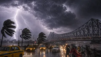
What the Forecast Holds
While the relief is immediate, the question on everyone's mind is: how long will it last? Weather forecasts for the next several days indicate that the pattern of cooler, wetter weather is likely to continue. Cities across East UP are predicted to see scattered to heavy thunderstorms. [5, 8] For instance, Gorakhpur's forecast includes a high chance of rain and a significant drop in maximum temperatures over the coming days. [5] The IMD has forecast that the monsoon will continue its advance across the state in the next few days. [10, 28] According to one forecasting service, the monsoon is expected to advance into East Uttar Pradesh by June 30 or July 1. [31] This suggests that the current relief is not just a fleeting break, but the beginning of the transition into the full-fledged monsoon season.