







A New 'Eye in the Sky'
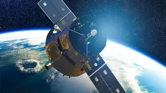
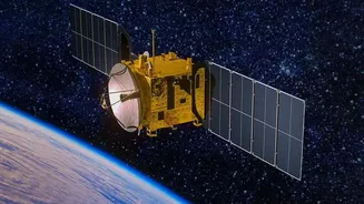
The Indian Space Research Organisation (ISRO) is scheduled to launch its latest Earth observation satellite, EOS-05, on September 4 from the Satish Dhawan Space Centre in Sriharikota. Also known as GISAT-1A, this spacecraft is not just another satellite;
it represents a paradigm shift in India's surveillance capabilities. Described by ISRO as the nation's first imaging satellite to be placed in a geosynchronous orbit, EOS-05 will act as a permanent sentinel, watching over the Indian subcontinent from an altitude of approximately 36,000 kilometres. This mission is a second attempt after an identical spacecraft, then called GISAT-1 or EOS-03, was lost during a launch failure in August 2021 due to a technical anomaly. The successful deployment of EOS-05 will place India in an elite club of nations with geostationary imaging capabilities.
The Power of Persistent Coverage
The key advantage of EOS-05 lies in its unique orbital position. Most of ISRO's current Earth observation satellites, like those in the Cartosat and RISAT series, operate in a Low Earth Orbit (LEO), which is much closer to the planet's surface. While LEO satellites provide high-resolution images, they are constantly moving and can only capture snapshots of a specific area when their orbit passes over it, which can take days. In contrast, a satellite in a geosynchronous orbit (GEO) matches the Earth's rotational speed, allowing it to 'hover' over a fixed geographical location. This enables EOS-05 to provide continuous, near-real-time monitoring of a vast region. The satellite will be able to image the entire Indian landmass every 30 minutes, with the capability to revisit areas of high priority as frequently as every five minutes. This persistence is crucial for tracking rapidly evolving situations like troop movements, natural disasters, or cyclones.
Guarding the Nation's Frontiers
The strategic implications of this persistent coverage for India's border security are immense. For the first time, defence and intelligence agencies will have the ability to maintain an uninterrupted watch over critical zones along the Line of Control (LoC) and the Line of Actual Control (LAC). This constant vigilance can provide early warnings of adversary movements, help monitor infrastructure build-up across the border, and offer crucial intelligence for strategic planning. The satellite is intended for both civilian and military applications. Beyond border surveillance, its advanced multispectral and hyperspectral imagers can be used for disaster management by tracking cyclones and forest fires, as well as for monitoring agriculture and the environment. With a high resolution of 42 metres per pixel from its lofty orbit, the satellite will provide detailed data for a wide range of national security and developmental needs.
A Technological Milestone for India
The EOS-05 mission is more than a strategic asset; it is a testament to India's growing prowess in space technology and a significant step towards 'Atmanirbhar Bharat' (self-reliant India) in the critical domain of space-based intelligence. The GSLV-F17 rocket that will carry the 2,367 kg satellite is a demonstration of ISRO's indigenous geosynchronous launch capability. The mission's success will not only redeem the 2021 launch failure but also solidify ISRO's reputation for executing complex space missions. By developing and deploying such an advanced satellite, India reduces its reliance on foreign intelligence and satellite imagery, gaining greater autonomy in its strategic decision-making processes. This sovereign capability ensures that India's security apparatus has timely and reliable data tailored specifically to its own national interests, a crucial element in today's complex geopolitical landscape.