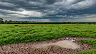


Mumbai's Drenching Welcome
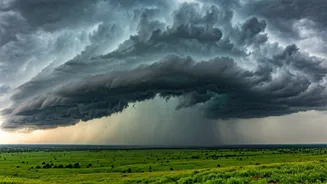
After a delayed and humid start to June, the monsoon finally arrived in Mumbai with characteristic intensity. The city has been receiving significant rainfall, with weather stations recording heavy to very heavy spells across the suburbs and island city.
For millions, this brought a much-needed respite from the oppressive pre-monsoon heat. The city's vital water-supplying lakes, which were at dangerously low levels, have also started seeing a gradual increase in their water stock. However, the joy is tempered by the usual monsoon woes: waterlogging in low-lying areas, traffic snarls that bring the city to a crawl, and disruptions to the local train network, the city's lifeline. It's the classic Mumbai paradox: the rain that gives life also threatens to grind it to a halt.
The National Rain Shadow
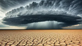
Zoom out from Mumbai's coast, and the picture looks drastically different. The headline figure of a 46% national deficit, as reported by the India Meteorological Department (IMD) in the latter half of June, paints a grim picture. This means that across the country, the rainfall received has been less than half of what is considered normal for this period. While this number is dynamic and can change rapidly, it points to a sluggish and delayed start to the monsoon over large swathes of India. Regions in North, Central, and even parts of East India have remained parch-dry, causing immense stress for the agricultural sector. The sowing of crucial Kharif crops like rice, soybeans, and pulses, which is timed with the monsoon's arrival, has been severely impacted in many states.
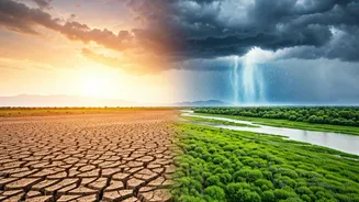
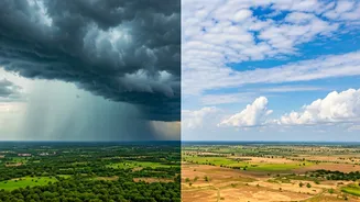
Why The Stark Contrast?
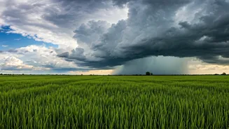
How can one city be flooded while the country is dry? The answer lies in the mechanics of the Indian monsoon. The Southwest Monsoon isn't a single weather event but has two main branches: the Arabian Sea branch and the Bay of Bengal branch. Mumbai and the western coast get their rain from the Arabian Sea branch. This year, strong westerly winds and the development of an offshore trough—a low-pressure area running parallel to the coast—have pulled immense moisture from the sea and dumped it over the Konkan coast, including Mumbai. Meanwhile, the Bay of Bengal branch, which is crucial for rainfall in eastern, central, and northern India, has been weak and has struggled to advance. This 'stalling' of one branch while the other is active is what creates this dramatic regional disparity in rainfall.
A Monsoon of Extremes
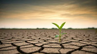
This pattern of erratic and uneven rainfall is becoming a recurring theme. Climate scientists have long warned that a warming world will lead to more intense and concentrated rainfall events, rather than the steady, moderate drizzles that are best for agriculture and groundwater recharge. We are witnessing this in real-time: long dry spells are being punctuated by short, furious bursts of rain that lead to floods. The situation in Mumbai, juxtaposed with the national deficit, is a textbook example. While the city copes with an excess of water in a short span, farmers in other states are anxiously scanning the skies for any sign of clouds. This variability makes water management and agricultural planning increasingly challenging for policymakers.
What's the Outlook?
The critical question is whether the monsoon will pick up pace and cover the deficit. The IMD remains hopeful, forecasting a revival and northward progress of the monsoon. The hope is that the Bay of Bengal branch will strengthen, bringing much-needed rain to the parched interiors of the country. A few weeks of widespread, active monsoon can significantly reduce the deficit. However, the initial delay has already set back the sowing calendar. The next few weeks are crucial. The performance of the monsoon in July, the most important month for rainfall, will determine the fate of the Kharif crop, rural incomes, and food inflation for the rest of the year. For now, India watches and waits, caught between the relief of localised downpours and the anxiety of a nationwide shortfall.