





The Challenge of Big Data
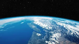
NASA's satellites are powerful eyes in the sky, constantly beaming back information about our oceans, atmosphere, and land. This data holds the key to understanding climate change, from melting ice caps to the intensity of wildfires. The problem has never
been a lack of data; it's been the overwhelming volume. By some estimates, NASA will manage nearly 600 petabytes of data by the early 2030s. Traditionally, scientists have had to manually sift through this information, a process that is both time-consuming and a significant bottleneck in our ability to respond to a rapidly changing world. Analyzing these massive datasets to find meaningful patterns has been a monumental challenge, limiting the speed at which science can provide answers.
An AI Model Named Prithvi
To tackle this data deluge, NASA partnered with IBM to develop a new kind of artificial intelligence. The result is a 'geospatial foundation model' named Prithvi, from the Sanskrit word for Earth. A foundation model is an AI trained on an enormous amount of unlabeled data, which allows it to recognize patterns that humans might miss. The Prithvi models were trained on years of harmonized data from NASA's Landsat satellites and the European Space Agency's Sentinel-2 satellites. Think of it like a student who has read an entire library of books on Earth science. It doesn't have a specific assignment yet, but it has a deep, foundational knowledge of the subject. This approach marks a significant milestone in applying AI to Earth science.
From General Knowledge to Specific Tasks
The power of Prithvi lies in its adaptability. Once the foundational learning is complete, the model can be quickly 'fine-tuned' for very specific tasks using much smaller, labeled datasets. For example, scientists can take the base model and train it to specifically identify the burn scars left by wildfires, map the extent of floodwaters after a hurricane, or classify different types of land use, such as deforestation or urban sprawl. This dramatically speeds up the process, turning what used to take months of work into a task that can be done much more rapidly. This flexibility is what makes it a 'smarter' monitoring system, acting like a powerful assistant for scientists.
Real-World Applications and Global Impact
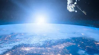
The potential applications are vast. The model has already demonstrated its ability to assist with disaster response, monitor changes in infrastructure, and even predict crop yields. For a country like India, the implications are significant. This technology could be used for near-real-time monitoring of Himalayan glaciers, which is critical for water availability. It could also provide faster and more accurate flood mapping during the monsoon season. One NASA official cited identifying flooding in India as a use case for these types of AI models. The technology is also being used to create systems for analyzing water availability in the Himalayas specifically. Further, it could help track air pollution over major cities and manage agricultural resources more effectively. Recently, a version of Prithvi became the first geospatial foundation model to be deployed and tested in orbit aboard the International Space Station, proving it can analyze data directly in space.
Open Science for a Planetary Challenge
Crucially, NASA and IBM have made the Prithvi models open-source, meaning they are freely available to researchers, startups, and scientists around the world via platforms like Hugging Face. This commitment to open science is designed to accelerate innovation and collaboration. By sharing these powerful tools, the agencies are empowering a global community to work together on some of the planet's most pressing environmental challenges. As one NASA official stated, making the models open source accelerates scientific and technological development by allowing anyone to use them. This collaborative approach is essential because climate change is a global problem that requires a global effort to understand and mitigate.