






A New, Unblinking Eye in the Sky
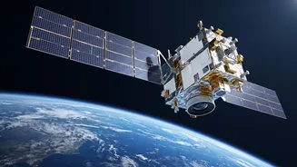
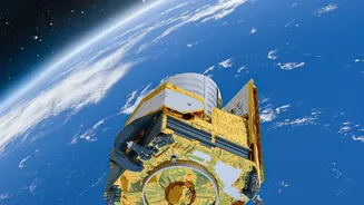
The EOS-05, also known as GISAT-1A, is not just another satellite; it's a state-of-the-art Earth observation spacecraft designed for a very specific and powerful orbit. Launched successfully aboard the GSLV-F17, its destination is a geosynchronous orbit approximately
36,000 kilometres above the Earth. Unlike satellites in lower orbits that pass over a location periodically, a geosynchronous satellite remains locked over the same spot. This gives EOS-05 the unique ability to continuously monitor the Indian subcontinent, providing a constant stream of data. Dubbed by some as an “Eye in the Sky,” it is India's first imaging satellite to operate from this high vantage point, marking a significant leap in the country's remote sensing capabilities.
What Makes It a Game-Changer
The 'revolutionary' aspect of the EOS-05 lies in its ability to provide frequent, near real-time imaging over large areas. Previous weather-monitoring satellites, like those in the INSAT series, have been the backbone of India's meteorological services for decades, providing crucial data on cloud cover, sea temperatures, and cyclones. However, EOS-05 enhances this with advanced imaging payloads, including multispectral and hyperspectral sensors. This allows it to capture images across different wavelengths of light, revealing details invisible to standard cameras. It can deliver an image of a selected area every five minutes and scan the entire Indian landmass every 30 minutes. This frequency is crucial for tracking rapidly developing weather events like thunderstorms and cyclones, giving forecasters an unprecedented edge.
From Data Streams to Dinner Plates
For a nation where agriculture is the backbone of the economy, accurate weather information is wealth. The data from EOS-05 will have a direct impact on farming. By providing detailed insights into soil moisture, crop health, and vegetation, it will help in making more precise agricultural forecasts. This information empowers farmers to make better decisions about planting, irrigation, and harvesting. Furthermore, improved monsoon tracking is vital. The Indian monsoon is a complex phenomenon, and satellites like EOS-05 provide the detailed imagery needed by the India Meteorological Department (IMD) to generate more reliable rainfall predictions, which are essential for national food security and water management.
Taming the Fury of Nature
One of the most critical applications of the EOS-05 mission is in disaster management. India's long coastline makes it vulnerable to cyclones, and its diverse geography exposes it to floods, landslides, and forest fires. The satellite's ability to provide continuous, real-time imagery is a massive asset for early warning systems. During a cyclone, forecasters can track its path and intensity with greater precision, enabling timely evacuations that save thousands of lives. For floods, it can map the extent of inundated areas even through cloud cover, helping authorities direct rescue and relief operations more effectively. This constant watchfulness allows for a more proactive, rather than reactive, approach to natural calamities, reducing loss of life and property.
A Key Piece of a Larger Vision
The EOS-05 mission is a significant milestone, but it's part of a broader strategy by ISRO to build a comprehensive, multi-layered Earth observation system. It complements the fleet of satellites in Low Earth Orbit (LEO), which provide high-resolution images, by adding a persistent, wide-area surveillance capability from a higher orbit. This mission, a replacement for the one lost in a 2021 launch failure, underscores India's resilience and commitment to self-reliance in space technology. As India aims to launch dozens more satellites in the coming years, missions like EOS-05 are crucial for everything from national security to urban planning and climate change monitoring. It strengthens India's capacity to manage its resources, protect its people, and build a more weather-resilient future.