





Understanding the Mission's Identity
While the headline refers to EOS-05, the mission that truly embodies this goal was GISAT-1, later renamed EOS-03. This satellite was designed to be India's first agile Earth-observation satellite placed in a geosynchronous orbit. The plan was to launch
a series of such satellites, with GISAT-2 (potentially to be named EOS-05) intended as the next in line. The naming convention is part of ISRO's broader categorisation of its Earth-observation assets. The core idea remains the same: to gain a persistent, real-time view of the Indian subcontinent from a fixed point in the sky.
What is a Geosynchronous Orbit?
Most Earth-observation satellites, like those in the Cartosat series, are in Low Earth Orbit (LEO), circling the planet every 90 minutes or so. They scan different parts of the globe with each pass. A geosynchronous orbit (GEO) is entirely different. It is located at a much higher altitude—about 35,786 kilometres above the equator. At this specific height, a satellite's orbital period matches Earth's rotation exactly. This means the satellite appears to hang stationary over one specific region of the planet. This provides a constant, unbroken view of a vast area, much like a fixed security camera watching over a large property.
The Strategic Advantage of a Fixed Gaze
The primary reason for placing an imaging satellite in GEO is to achieve continuous monitoring. Unlike LEO satellites that pass over a location intermittently, a GEO satellite can provide near real-time imagery of a large area, such as the entire Indian landmass and its surrounding oceans. The objective for EOS-03 was to image the whole country every 30 minutes and specific areas of interest as frequently as every five minutes. This capability is invaluable for several key applications. It allows for rapid tracking of natural disasters like cyclones, floods, and forest fires as they develop. For national security, it offers persistent surveillance of border areas and maritime regions, a significant strategic asset. It also has major benefits for agriculture, forestry, and monitoring water bodies.
The Challenge of Reaching GEO
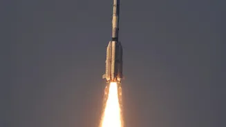
Placing a heavy satellite into such a high orbit is a complex and demanding task. It requires a powerful rocket like ISRO's Geosynchronous Satellite Launch Vehicle (GSLV). The GSLV is a three-stage rocket, and its most critical component is the indigenously developed cryogenic upper stage. This stage uses propellants at extremely low temperatures to generate the immense thrust needed to push the satellite from a lower transfer orbit into its final geosynchronous path. Mastering cryogenic technology is a significant engineering feat, one achieved by only a handful of space-faring nations.
The Setback and the Path Forward
The GSLV-F10 mission carrying the EOS-03 satellite in August 2021 unfortunately ended in failure. The rocket's first and second stages performed normally, but a technical anomaly prevented the cryogenic upper stage from igniting. A failure analysis committee later determined that a leak in a valve led to a pressure drop in the liquid hydrogen tank, causing the engine's fuel pump to malfunction. This setback was a major disappointment but also a valuable learning experience. Following the failure of EOS-03, ISRO successfully launched EOS-05 on September 4, 2026, aboard a GSLV-F17 rocket, making it India's first imaging satellite to operate from a geosynchronous orbit. This success marked a huge step forward in achieving the goal of constant observation from a high perch.