








The Losing Battle of Reactive Repairs
Across India, from Mumbai to Bengaluru and beyond, the narrative is the same: heavy rains expose deep flaws in our urban infrastructure. We see newly built expressways developing potholes and even collapsing, and city drainage systems, often old and encroached
upon, quickly become overwhelmed. The response is predictable. Municipal bodies and public works departments launch into a flurry of activity, patching roads and clearing drains after the damage is done. This approach is a constant, expensive game of catch-up. It treats the symptoms—potholes, waterlogging—without addressing the underlying disease: a lack of predictive planning. This cycle is not only financially draining but also creates massive disruptions to economic activity and daily life, revealing systemic challenges in how we build and maintain our cities.
What a Data-First Approach Looks Like
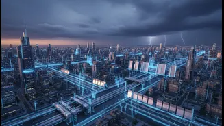
Shifting to a data-driven model means moving from reaction to prediction. Instead of just fixing what’s broken, it involves building systems that tell us what is likely to break. This is now possible with technologies like the Internet of Things (IoT), AI-powered analytics, and Digital Twins. Imagine low-cost, solar-powered sensors placed in stormwater drains and canals that give real-time updates on water levels. This data, when combined with high-resolution rainfall forecasts from agencies like the IMD, can create a powerful predictive engine. We can simulate how a specific amount of rain will affect different parts of a city, identifying the exact culverts that will overflow or the neighbourhoods most at risk, hours or even days in advance.
From Prediction to Proactive Action
The true power of data lies in the actions it enables. Knowing a specific area is likely to flood allows authorities to move from crisis management to proactive intervention. Resources can be pre-deployed to vulnerable spots. Pumping stations can be activated automatically based on sensor readings, not just when an area is already submerged. Traffic can be rerouted before gridlock occurs, and emergency response teams can be placed on standby in high-risk zones. Small-scale but successful pilots are already demonstrating this potential. In Gorakhpur, an AI-based system has shown significant improvement in mitigating waterlogging by providing accurate 24-hour forecasts. Similarly, Chennai has used citizen-driven flood mapping via a mobile app to enhance its predictive models and response times.
The Challenge is Governance, Not Just Technology
While the technology exists, the biggest hurdles are often institutional. Urban flood management in India is frequently hampered by fragmented governance, with responsibilities split across multiple departments like public works, irrigation, and municipal corporations, leading to weak coordination. Urban Local Bodies, the frontline agencies, are often under-funded and lack the authority to implement city-wide plans. The good news is that frameworks like the Smart Cities Mission and initiatives like the National Geospatial Mission are pushing for greater adoption of these technologies. Cities like Mumbai, Chennai, and Kolkata are beginning to develop real-time simulation models, but these efforts need to be scaled up and integrated into a single, accountable system for managing urban flood resilience.