





A Landmark International Partnership
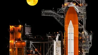
The NISAR mission represents one of the most significant collaborations between the U.S. and Indian space agencies. Launched on July 30, 2025, from India's Satish Dhawan Space Centre, this joint Earth-observing satellite is one of the most expensive of its
kind, with a cost of around $1.5 billion. Under the agreement, NASA provided the L-band radar system, while ISRO contributed the S-band radar, the satellite bus, and the GSLV launch vehicle. This partnership allows for a pooling of resources and expertise, creating a tool more powerful than either agency could have developed alone. The mission is a testament to the strengthening strategic relationship between the two nations, aiming to deliver tangible benefits on Earth.
How NISAR Sees the Unseen
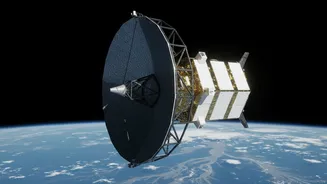
What makes NISAR so special is its use of Synthetic Aperture Radar (SAR). Unlike optical satellites that are hindered by clouds or darkness, radar can see through them, providing reliable data day or night, in any weather. NISAR is the first satellite to use two different radar frequencies (L-band and S-band) simultaneously. This dual-frequency capability allows it to measure changes on the Earth’s surface with unprecedented precision—down to a centimetre. The satellite orbits the planet every 12 days, scanning a 242-kilometre-wide strip of the surface, which allows it to systematically map the entire globe and create a constantly updating picture of our dynamic planet.
Transforming Disaster Response in India
For a country like India, which is prone to floods, earthquakes, landslides, and cyclones, NISAR’s capabilities are a game-changer. The satellite can detect subtle ground deformations that may precede earthquakes or landslides, offering a chance for early warnings. Its ability to see through cloud cover is invaluable for monitoring flooding during heavy monsoon seasons, helping authorities to map inundated areas and plan rescue operations more effectively. In the event of a disaster, data can be made available within hours to support emergency response teams on the ground. This has already been demonstrated in practice; data from NISAR was used to map ground shifts of up to 60 centimetres after recent earthquakes in Venezuela, showcasing its rapid response potential.
More Than Just Disasters
While its role in disaster management is critical, NISAR’s applications extend much further. The data will provide crucial insights for managing India's agricultural sector by monitoring soil moisture and crop health, leading to better resource management and food security. It will also track the health of vital ecosystems, from forests and wetlands to coastal mangroves. Furthermore, the mission will monitor changes in ice sheets and glaciers in the Himalayas, providing vital information related to climate change and its impact on water resources for millions of people downstream. ISRO has already begun releasing S-band data to the public through its Bhoonidhi portal, making it accessible for researchers, planners, and the public.