





A Fragile Frontline
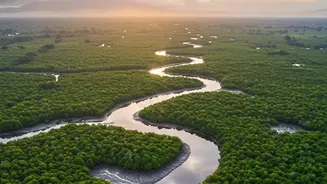
The Sundarbans, the world's largest contiguous mangrove forest, is a place of immense natural beauty and critical ecological importance. Straddling India and Bangladesh, this UNESCO World Heritage Site is home to the iconic Bengal tiger and provides livelihoods
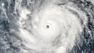
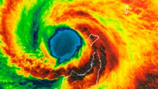
for millions of people. However, it is also one of the most climate-vulnerable regions on Earth. Facing a faster rate of sea-level rise than almost anywhere else, coupled with the increasing frequency and intensity of cyclones spinning out of the Bay of Bengal, the region's inhabitants and its unique ecosystem are under constant threat from erosion, flooding, and saltwater intrusion.
Nature's Living Shield
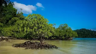
For centuries, the primary defense for the Sundarbans has been the mangroves themselves. These remarkable salt-tolerant trees act as a natural, living sea wall. Their complex and dense root systems trap sediment, stabilising the coastline and literally building land. The tangled web of trunks, roots, and canopy acts as a powerful brake, absorbing and dissipating the energy of storm surges and cyclones, significantly reducing their destructive impact on the communities sheltered behind them. Studies have shown that areas protected by healthy mangrove forests experience substantially less damage and fewer fatalities during extreme weather events.
Eyes in the Sky Confirm Success
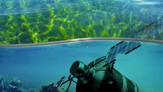
While the protective benefits of mangroves are well-known, verifying the success of large-scale restoration projects has traditionally been a slow, ground-based process. This is where satellite technology has become a game-changer. Using data from programs like NASA's Landsat and the European Space Agency's Sentinel satellites, scientists can now monitor vast, inaccessible areas of the Sundarbans with incredible precision. By comparing images over time, they can track changes in mangrove density, canopy health, and, crucially, the stability of the shoreline. This high-tech surveillance provides clear, quantifiable evidence of how and where restoration efforts are paying off, showing not just an increase in green cover, but measurable gains in land and reduced erosion.
From Planting to Protection
Decades of deforestation had weakened this natural shield, but concerted efforts by government bodies and NGOs are turning the tide. Community-led projects, often empowering local women, have been central to replanting millions of mangrove saplings along degraded coastlines and embankments. Satellite analysis now confirms that these efforts are yielding rapid results. In areas where mangroves were planted following the devastating Cyclone Aila in 2009, the grown forests acted as an effective bio-shield against later cyclones like Amphan, preserving embankments and protecting villages. The data from above validates the hard work on the ground, proving that restoration is not a theoretical exercise but a practical, effective strategy for immediate climate adaptation. It also helps identify hotspots of stress or degradation, allowing for more targeted conservation efforts.
A Blueprint for Coastal Resilience
The success story unfolding in the Sundarbans offers a powerful blueprint for coastal regions across India and the world. It demonstrates that nature-based solutions, when coupled with scientific monitoring, are among the most effective and sustainable ways to build resilience. These projects do more than just defend the coast; they restore biodiversity, act as massive carbon sinks, and create sustainable livelihood opportunities for local communities, from fishing and crab collecting to honey production. As India looks to strengthen its vast coastline against the impacts of climate change, the evidence mapped by satellites in the Sundarbans shows a clear path forward: investing in nature is an investment in our collective security.