






A Partnership For The Planet
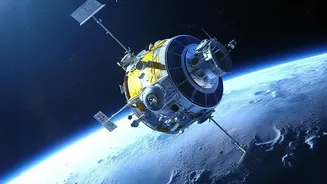
At the heart of this collaboration is the NASA-ISRO Synthetic Aperture Radar (NISAR) mission, a state-of-the-art Earth observation satellite. Jointly developed by the two space agencies, NISAR is the first satellite to use two different radar frequencies
(L-band and S-band) to monitor changes on our planet's surface with incredible precision. While NASA provided the L-band radar and other key components, ISRO contributed the S-band radar, the spacecraft itself, and the launch vehicle. This powerful union of expertise aims to provide invaluable data on everything from ecosystem disturbances and melting ice sheets to natural hazards like earthquakes and, crucially for India, floods. The mission will scan nearly the entire globe every 12 days, offering a reliable and consistent stream of high-resolution data.
Seeing Through Clouds and Darkness
One of the biggest challenges in monitoring floods, especially during India's monsoon season, is persistent cloud cover. Traditional optical satellites are often rendered useless, unable to see the ground below. This is where NISAR's technology becomes a game-changer. Its Synthetic Aperture Radar (SAR) can penetrate clouds, rain, and darkness, ensuring that data can be collected day or night, regardless of the weather. The L-band radar is particularly effective at this, capable of not only spotting open water but also detecting flooding in areas covered by forests and vegetation—a phenomenon known as 'flooded vegetation' which is difficult for many other sensors to identify. This means that for the first time, authorities can get a clear picture of inundation even in dense jungles or agricultural fields.
From Days to Hours
Speed is critical during a disaster. The 'faster' aspect of these new tools refers to the dramatically reduced time it takes to get actionable information to emergency responders. In disaster scenarios, NISAR's data products are expected to be available within hours of observation, a significant leap from the one to two days it might take for regular data processing. The satellite will pass over the same spot on Earth every 12 days, and with ascending and descending orbits, coverage can be as frequent as every 6 days on average. This rapid revisit time allows for the creation of near-real-time flood maps, showing how the situation is evolving on the ground. This allows disaster management teams to make quicker, more informed decisions about where to deploy resources, which areas to evacuate, and how to plan rescue operations.
A Clearer, More Powerful Picture
The 'power' of NISAR lies in its precision and the depth of its data. The satellite can detect changes in the Earth's surface as small as a centimetre. For floods, this means it can function like a 'virtual stream gauge,' precisely measuring changes in water levels in flooded areas, even far from established river monitoring stations. With a resolution of 5-10 meters, it can map the extent of flooding with unprecedented detail. The dual-frequency radar provides a more comprehensive dataset; the L-band penetrates canopies to see water on the forest floor, while the S-band is excellent for monitoring agricultural areas and other applications. This detailed information helps not only during the crisis but also after, enabling more accurate damage assessments for crops and infrastructure.
Real-World Impact for India
For India, a country where floods cause immense loss of life and property annually, the operationalization of NISAR data is a transformative development. ISRO is already a key player in the country's Disaster Management Support Programme, using satellite data for early warning and damage assessment. The data from NISAR will be integrated into these existing frameworks, significantly boosting their capabilities. National and state disaster management agencies will have access to highly accurate, all-weather inundation maps that can pinpoint vulnerable areas with greater certainty. This leads to more effective resource allocation, better-planned evacuations, and ultimately, the potential to save countless lives and livelihoods. The mission is a testament to how international scientific collaboration can yield tangible benefits for people on the ground.