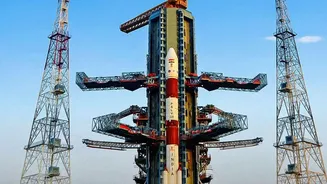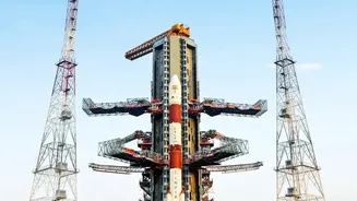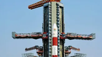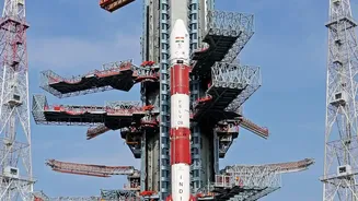





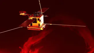

The Indian Space Research Organisation (ISRO) is continuing its mission to bolster the nation's self-reliance in space-based navigation. The upcoming launch of the NVS-03 satellite aboard a GSLV rocket marks a critical step in that journey.
The Workhorse: GSLV-F18
The Geosynchronous
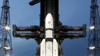
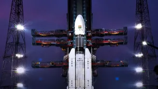
Satellite Launch Vehicle (GSLV) is one of ISRO's most important rockets, designed to place heavy satellites into Geosynchronous Transfer Orbit (GTO). This three-stage rocket, standing nearly 50 meters tall, is a powerhouse with a lift-off mass of around 420 tonnes. Its most crucial component is the indigenously developed cryogenic upper stage, which uses liquid hydrogen and liquid oxygen as propellants. This advanced technology gives the GSLV the thrust needed to deliver payloads to high-altitude orbits, approximately 36,000 km above Earth. The GSLV-F18 mission is the 20th flight for this vehicle class, highlighting its long and increasingly reliable service history. Each launch builds on the last, solidifying the GSLV's role as the go-to vehicle for India’s most ambitious communication and navigation satellite deployments.
The Payload: NVS-03 Satellite
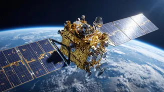
At the top of the rocket sits the NVS-03, a next-generation navigation satellite weighing roughly 2,250 kg. It is the third satellite in the new 'NVS' or Navigation with Indian Constellation (NavIC) series, designed to augment and eventually replace the older Indian Regional Navigation Satellite System (IRNSS) satellites. The NVS series represents a significant technological leap. One of the most important upgrades is the inclusion of an indigenously developed Rubidium atomic clock. These clocks are the heart of any navigation system, providing the ultra-precise time measurements needed to calculate a user's exact position. Failures in imported atomic clocks on earlier satellites hampered the NavIC constellation, making this homegrown solution a major step towards complete self-sufficiency.
Strengthening India's Own GPS
The ultimate purpose of the NVS-03 mission is to strengthen NavIC, India's autonomous regional navigation system. Often called India's answer to the American GPS, NavIC provides crucial Position, Navigation, and Timing (PNT) services. The need for an independent system was starkly highlighted during the 1999 Kargil War, when access to foreign GPS data was not guaranteed. NavIC ensures that India's defence forces have secure, encrypted, and uninterrupted access to navigation data. For civilians, it offers services for vehicle tracking, disaster management, and maritime navigation, covering the entire Indian mainland and a region extending 1,500 km beyond its borders. The NVS satellites improve this service by adding a new L1 frequency band, the same one used by most civilian smartphones and devices for GPS, which promises to make NavIC integration into everyday technology much more seamless.
The Journey to Orbit
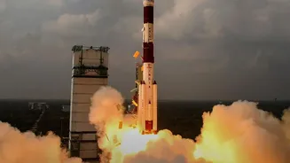
The launch from the Satish Dhawan Space Centre in Sriharikota is a complex, precisely choreographed event. After lifting off, the GSLV-F18 will fly for approximately 19 minutes before deploying the NVS-03 satellite into a highly elliptical Geosynchronous Transfer Orbit (GTO). This initial orbit has a low point (perigee) of around 170 km and a high point (apogee) of over 37,000 km. From there, the mission is far from over. ISRO's ground control will take over, performing a series of delicate orbit-raising manoeuvres over several days. Using the satellite's own onboard propulsion system, engineers will gradually circularise its orbit, eventually placing it in its final geosynchronous slot. Once there, after deploying its solar panels and undergoing system checks, NVS-03 will join the NavIC constellation and begin its planned 12nd operational life, beaming down the signals that keep India on the map.