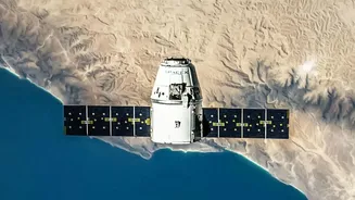







An Eye That Never Blinks
Most Earth observation satellites operate in Low Earth Orbit (LEO), circling the globe and passing over a specific area only periodically. Think of them as photographers flying on a fixed airline route; they can take great pictures, but only when their
flight path aligns with the target. A geosynchronous satellite, on the other hand, is completely different. Placed at an altitude of nearly 36,000 kilometres, its orbit is synchronised with the Earth's rotation. From our perspective, it appears to hover over a fixed spot. This allows EOS-05 to provide near-continuous monitoring of the Indian landmass, a capability ISRO has called a 'state-of-the-art' advancement for the nation.
The Geosynchronous Advantage
The key advantage of EOS-05 is persistence. Instead of fleeting glimpses, it can provide repeated images of large areas at frequent intervals. Reports indicate the satellite can image the entire Indian landmass approximately every 30 minutes and revisit specific areas of interest in as little as five minutes. This persistent stare is a game-changer. While LEO satellites like the NASA-ISRO Synthetic Aperture Radar (NISAR) can see through clouds, they have to wait for their orbit to bring them back over a location. EOS-05, by contrast, stays with the story as it unfolds, although its view can be obscured by cloud cover. This makes it a complementary system, not a replacement, for India's existing fleet of remote sensing satellites.
Transforming Disaster Management
For a country prone to natural disasters like cyclones, floods, and forest fires, the ability to watch events unfold in near real-time is invaluable. Current satellites provide crucial data, but a geosynchronous imager elevates this to a new level. During a rapidly developing cyclone, for example, authorities can get updated imagery every few minutes, allowing for more accurate track prediction and timely warnings for evacuation. This rapid revisit capability means emergency response teams can monitor floodwaters, track the spread of wildfires, and assess damage with unprecedented speed, potentially saving countless lives and resources.
A Boost for Agriculture and Water Security
Beyond disasters, constant observation offers significant benefits for India's vast agricultural sector. The satellite's multi-spectral and hyper-spectral cameras can monitor crop health, soil moisture levels, and vegetation stress over wide areas. This data can help create more accurate agricultural output estimates, provide early warnings for pest attacks or drought conditions, and enable more efficient water resource management by continuously monitoring reservoir levels across the country. It provides a broad, regional intelligence layer that helps scientists and policymakers identify where closer, on-the-ground investigation is needed most urgently.
A Strategic Edge
While ISRO officially highlights the civilian applications, the strategic utility of a persistent eye over the region is undeniable. The ability to frequently monitor borders, maritime zones, and other sensitive areas provides a significant national security advantage. This type of platform can detect changes and movements that might be missed by satellites that pass over only once every few days. The successful launch of EOS-05, also known as GISAT-1A, represents a major step forward, especially after a previous attempt with the EOS-03 satellite ended in a launch failure in 2021. This mission's success demonstrates India's growing capability and resilience in the space sector.