






What is EOS-05?
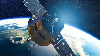
EOS-05 is a sophisticated Earth observation satellite developed by ISRO. Also known as GISAT-1A, it is part of India's GEO Imaging Satellite (GISAT) series. The satellite is scheduled to be launched aboard a GSLV-F17 rocket from the Satish Dhawan Space
Centre in Sriharikota. Weighing approximately 2,367 kg, EOS-05 is designed to be India's first imaging satellite placed in a geostationary orbit, a high-altitude position about 36,000 kilometres above the equator. This specific orbit allows the satellite to remain in a fixed position relative to the Earth's surface, providing a constant watch over the Indian subcontinent.
A Game-Changer in the Sky
The key advantage of EOS-05 is its geostationary orbit. Most earth observation satellites are in low-earth orbits, meaning they pass over a specific location only periodically. EOS-05, however, will offer a persistent eye, enabling near-real-time monitoring. It is expected to capture images of the entire Indian landmass every 30 minutes. For areas of high priority, such as a developing cyclone or a flood-affected region, it can revisit and provide updated imagery in as little as five minutes. This frequent, rapid-refresh capability represents a major leap forward from previous satellites, which had longer revisit times.
Better Weather Forecasting
For a country heavily dependent on the monsoon and vulnerable to cyclones, accurate weather forecasting is critical. EOS-05 is poised to make a significant impact in this area. Its ability to continuously monitor cloud cover, weather systems, and atmospheric conditions will provide invaluable data to meteorologists. The near-real-time imagery can help in the early detection and tracking of cyclones, providing more precise information about their intensity and path. This leads to more timely and accurate warnings for coastal communities, allowing for better preparedness and potentially saving countless lives. The frequent updates will also improve short-range weather forecasts across the country.
Strengthening Disaster Management
Beyond weather, EOS-05's capabilities extend to a wide range of natural disasters. The satellite's multi-spectral and hyperspectral imaging sensors will aid in monitoring various phenomena. During floods, it can quickly map the extent of inundated areas, helping disaster response teams identify the worst-hit regions and plan rescue operations more effectively. For droughts, it can assess soil moisture and crop health over large areas. The satellite will also be a crucial tool for monitoring forest fires, detecting active fires, and tracking their spread. Its applications also include monitoring changes in land and water bodies, assessing agricultural conditions, and even assisting in security and strategic observation.
The Road to Launch
The EOS-05 mission is particularly significant as it follows the unsuccessful launch of its predecessor, GISAT-1 (also designated EOS-03), in August 2021 due to an issue with the GSLV rocket. The upcoming GSLV-F17 mission carrying EOS-05 marks a return to this ambitious geo-imaging concept. A successful launch will not only deploy a vital national asset but also reaffirm the reliability of ISRO's GSLV launch vehicle for placing heavy satellites into high-energy orbits. The mission represents a crucial step in building a more climate-resilient India, using advanced space technology to safeguard its population and resources against the increasing threat of extreme weather events and natural calamities.