


The Monsoon's Sudden Pause
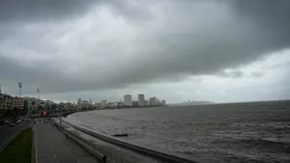
The Southwest Monsoon, the lifeblood of India's agriculture-driven economy, began its 2024 journey with vigour. It made an early onset over Kerala and swept through southern and western states, including an earlier-than-usual arrival in Mumbai. For a while,
it seemed like a textbook-perfect advance. But just as it began pushing into the heart of the country, it hit an invisible barrier. The Northern Limit of Monsoon (NLM), the imaginary line marking the farthest advance of the rains, has remained static for several days, refusing to budge further into key regions of central and northern India. This abrupt halt has turned initial optimism into a period of watchful waiting.
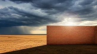
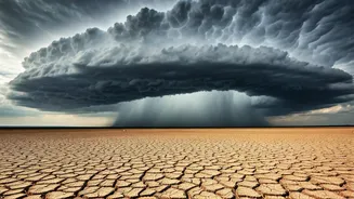
What Is This 'Atmospheric Wall'?
The ‘wall’ isn’t a physical object, but a powerful weather system known as an anticyclonic circulation. Think of it as a giant, invisible dome of high-pressure air parked over west-central India. Under a high-pressure system, air sinks. This sinking motion suppresses the formation of clouds and rain. The monsoon, which is essentially a flow of moisture-laden winds from the sea, needs low-pressure conditions and rising air to create rain. When these winds encounter the heavy, sinking air of the anticyclone, they are effectively blocked, unable to rise, cool, and condense into rain clouds. The monsoon winds are still present, but the conditions above them are simply not conducive to rainfall, causing the system to stagnate.
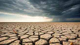
Which Regions Are Feeling the Heat?
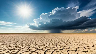
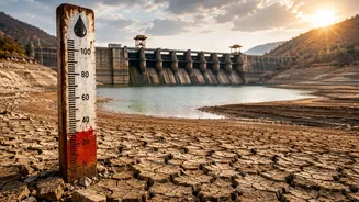
This stall is having a direct impact on vast swathes of India's agricultural belt. The regions currently stuck on the dry side of the monsoon line include parts of Gujarat, Madhya Pradesh, Chhattisgarh, Odisha, and further north into Uttar Pradesh and Bihar. For farmers in these areas, this is a critical period. They have prepared their fields for Kharif crops like soybean, cotton, paddy, and pulses, but cannot begin sowing until the soil has sufficient moisture. A delay of a week might be manageable, but a prolonged dry spell can disrupt the entire cropping calendar, potentially affecting yields and, by extension, food prices later in the year. The pre-monsoon showers were promising, but it's the sustained monsoon rain that truly matters.
Is This a 'Break Monsoon' Phase?
Meteorologists are careful with their terminology here. A brief pause like this is not uncommon during the four-month monsoon season. The advance often happens in spurts rather than a smooth, continuous sweep. However, if this stall extends for a longer period, it could be classified as a 'break monsoon' phase—a prolonged period of little to no rain over the core monsoon zone. The India Meteorological Department (IMD) and private forecasters are closely monitoring the situation. The current consensus is that this is a temporary halt. Favourable conditions are expected to develop that could help weaken the anticyclone and get the monsoon moving again.
What Needs to Happen for a Revival?
For the monsoon to resume its journey, the atmospheric roadblock must be cleared. This can happen in two primary ways. First, the anticyclonic system itself could weaken and move away. Second, and more significantly, is the formation of a low-pressure area or a cyclonic circulation, typically in the Bay of Bengal. Such systems act like powerful engines, pulling the monsoon currents towards them and re-energising the entire flow across the country. Forecasters are currently watching the Bay of Bengal for signs of such a development. Most weather models indicate that the monsoon could revive and begin its northward advance once again in the coming week, finally bringing much-needed rain to the waiting regions.