







From Vague Predictions to Pinpoint Alerts
For decades, weather forecasts in India were broad, often covering entire states or large regions. A "heavy rainfall expected" warning left citizens and officials wondering exactly where and when the impact would be felt. In recent years, however, the IMD
has made a significant leap forward. By leveraging a denser network of Doppler radars, automatic weather stations, and advanced high-resolution modelling systems, the agency has moved towards what it calls Impact-Based Forecasting (IBF). This new approach focuses not just on what the weather will be, but on what it will do. The result is a more granular system that can issue warnings at the district, city, and even block level. These alerts, often delivered through the 'Mausam' app and the Common Alerting Protocol (CAP) system, provide highly localized warnings for events expected within the next few hours—a critical timeframe for commuters and transport authorities alike.
Keeping India's Trains on Track
Indian Railways, the lifeline of the nation, is a primary beneficiary of this improved forecasting. Heavy rains pose numerous threats, from track inundation and signal failures to landslides in hilly sections. In close coordination with the IMD, railway divisions now receive real-time weather alerts that enable proactive decision-making. For instance, upon receiving a 'red' or 'orange' alert for a specific district, railway authorities can deploy patrol teams to inspect vulnerable sections of track before the rain intensifies. They can also impose temporary speed restrictions or, in extreme cases, reschedule or cancel services to prevent trains from getting stranded in dangerous conditions. Some zones, like the Northeast Frontier Railway, have installed their own Automatic Weather Stations at strategic locations to get even more localized data on rainfall and wind speed, allowing for a swift and targeted response.
Navigating Roads in the Monsoon
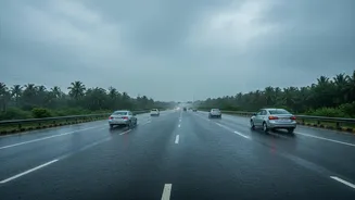
On the roads, the challenges are just as complex. Urban waterlogging can bring a city to a standstill, while landslides can sever critical highway links for days. District-level warnings are designed to give municipal corporations and highway authorities a crucial head start. Recent examples from states like Gujarat and Kerala show this in action. Following red alerts from the IMD, district administrations have issued advisories urging residents to stay indoors, ordered the closure of factories and schools, and pre-emptively evacuated people from low-lying areas. These alerts allow disaster response teams (like the NDRF and SDRF) to be deployed to anticipated hotspots before the situation turns critical. For road transport, this can mean pre-positioning water pumps in flood-prone underpasses, issuing traffic diversions, and advising commuters to avoid specific routes, thereby preventing widespread gridlock.
The Persistent Gap Between Forecast and Action
Despite these technological advancements, a significant gap often remains between receiving a warning and implementing an effective on-ground response. One of the biggest hurdles is inter-agency coordination. For a forecast to be effective, the IMD, the National and State Disaster Management Authorities, railway control rooms, local police, and municipal bodies must all be in sync—a complex task where communication can falter. Furthermore, local bodies may lack the resources or the authority to take drastic, costly preventive measures based on a forecast that, while much improved, still carries a degree of uncertainty. A decision to shut down a major highway or suspend a city's local train service has massive economic and social consequences, making officials hesitant to act pre-emptively. This results in a reactive, rather than proactive, approach, where action is often taken only after disaster has struck.
Building a More Resilient Future
The move towards district-level and impact-based forecasting is undeniably a major step towards making India's transport infrastructure more weather-resilient. The accuracy of IMD's forecasts has shown marked improvement, especially since 2021 with the adoption of new multi-model systems. The development of specialized highway forecasts, providing route-specific information on rainfall and visibility, is another promising innovation. However, technology alone is not a silver bullet. Closing the gap will require strengthening last-mile communication, empowering local officials to make timely decisions, and fostering a culture of preparedness among the public. As climate change makes extreme weather events more frequent and intense, the ability to translate a precise forecast into a swift, coordinated action on the ground will be more critical than ever.