





The Familiar Scene of Urban Flooding
For residents of Mumbai, Chennai, Kolkata, and Bengaluru, the sight of submerged roads, stranded vehicles, and inundated homes is an all-too-common monsoon reality. Rapid urbanisation, coupled with ageing and often inadequate drainage infrastructure,
means that even a few hours of intense rainfall can overwhelm the system. Traditionally, flood management has been a reactive process. Municipal teams scramble to clear blockages and operate pumps after the water has already risen, leading to significant property damage, economic disruption, and risk to human life. This approach is like trying to bail out a boat that already has a major leak—it’s a constant, exhausting, and often losing battle.
The 'Smart' Shift: What Are IoT Sensors?
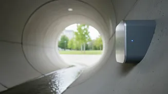
Imagine a network of digital sentinels placed throughout a city’s stormwater drains, canals, and rivers. This is the core idea behind using the Internet of Things (IoT) for flood management. These are not just simple cameras; they are small, rugged devices equipped to measure critical data points in real time. The most important sensors for flood management measure water level, flow rate, and rainfall intensity. Each sensor is connected wirelessly to a central data hub, constantly feeding it information about what’s happening in the city's water network, moment by moment. This transforms a city's drainage system from an invisible, unmonitored network into a living, digitally mapped entity.
Creating a Digital Map of Water Flow
This continuous stream of data from hundreds of sensors is where the magic happens. The information is fed into a central platform that uses advanced software, often incorporating Geographic Information Systems (GIS) and artificial intelligence (AI), to create a dynamic, real-time map of the city's water flow. This is sometimes referred to as a 'digital twin'—a virtual replica of the physical drainage network. Instead of guessing where a problem might be, city officials can see it developing on a screen. They can identify the exact locations where water levels are rising dangerously, where a drain is blocked and causing a backup, or which parts of the network are approaching full capacity.
From Prediction to Proactive Response
This real-time map fundamentally changes the game from reaction to prevention. By analysing the data and flow patterns, AI-driven models can predict with high accuracy which areas are likely to flood in the next few hours. This provides a crucial window for early warnings. Automated alerts can be sent to residents in at-risk areas via mobile apps, giving them time to move vehicles or prepare their homes. More importantly, it allows for an incredibly efficient deployment of resources. Instead of dispatching teams blindly, municipal corporations can send cleaning crews to the precise location of a detected blockage or activate remote-controlled sluice gates to divert water flow away from overwhelmed channels. This targeted, proactive approach saves time, money, and can significantly reduce the overall impact of a heavy downpour.
The Indian Context: Pilots and Progress
This technology is no longer just theoretical; it's being put to the test in India. As part of the Smart Cities Mission, several cities have begun implementing IoT-based water management and flood warning systems. Surat, once notorious for floods, has successfully used an IoT-based monitoring system to become a more resilient city. Chennai has collaborated with IIT Madras on a real-time flood forecasting system that uses IoT sensors and AI to predict water accumulation zones. Kolkata has also implemented a city-level flood forecasting system funded by the Asian Development Bank. While challenges like sensor maintenance and initial investment costs remain, these pilot projects are proving the immense value of data-driven disaster management. Kerala, too, is leveraging AI and IoT sensors to enhance its flood preparedness after facing devastating floods in recent years.