




ISRO's Gateway to Geospatial Skills
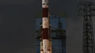
The Indian Space Research Organisation (ISRO), through its premier training body, the Indian Institute of Remote Sensing (IIRS) in Dehradun, regularly offers a suite of online and in-person courses designed to build expertise in space technology. These
programmes, often free of charge, are part of ISRO's outreach to strengthen academia and user segments in the applications of space technology. The courses are available to a wide audience, including undergraduate and postgraduate students, researchers, and government or private sector professionals. The goal is to develop a new generation of trained professionals in remote sensing, geoinformatics, and related technologies for managing natural resources, the environment, and disasters. Upon completion, participants often receive a certificate, adding a valuable credential to their profile.
The Power of Synthetic Aperture Radar (SAR)
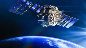
At the heart of modern Earth observation is Synthetic Aperture Radar (SAR). Unlike traditional optical satellites that depend on sunlight and clear skies, SAR is an active sensing technology. It sends its own microwave pulses to the Earth's surface and records the returning signal. This allows it to 'see' through clouds, rain, and smoke, and operate both day and night. This all-weather, 24/7 capability is crucial for applications in India, such as monitoring floods during the monsoon, tracking agricultural health, managing natural disasters like landslides, and keeping an eye on our strategic interests. ISRO's own RISAT series of satellites are equipped with SAR, making it a cornerstone of the country's observation capabilities. The upcoming NASA-ISRO SAR (NISAR) mission will further enhance these capabilities, making expertise in SAR data analysis more valuable than ever.
What Will You Learn?
While the exact curriculum varies with each course announcement, IIRS programmes on SAR typically cover the fundamentals of the technology and its applications. Participants can expect to learn the basic principles of microwave remote sensing and how SAR creates detailed images of the Earth's surface. Core topics often include an introduction to SAR data processing, image interpretation, and specialised techniques like Interferometric SAR (InSAR), which is used to measure tiny, centimetre-scale ground movements for studying earthquakes, land subsidence, and glacier flow. Courses frequently involve hands-on practical sessions using open-source software and real datasets from satellite missions, ensuring that learners gain practical, job-ready skills.
Who is This Training For?
ISRO and IIRS design these courses to be widely accessible. The target audience typically includes students in their final year of an undergraduate degree or those pursuing postgraduate studies in fields like physical sciences, engineering, geography, agriculture, or environmental science. Technical and scientific staff from central and state government departments, as well as faculty and researchers at universities, are also encouraged to apply. Registration is usually done online through the IIRS portal, where individuals can register either independently or through their educational institution, which may be a registered nodal centre for IIRS outreach programmes. Given the high demand and limited seats, these courses often fill up on a first-come, first-served basis.
The Career Advantage in a Growing Sector
Completing an ISRO course in SAR is more than just an academic exercise; it's a strategic career move. The geospatial technology sector in India is projected to grow significantly, potentially creating over a million jobs by 2030. With the privatisation and commercialisation of the space sector, a new ecosystem of startups is emerging, all hungry for satellite data and the talent to analyse it. These companies are focused on providing services for agriculture, infrastructure monitoring, and climate change analysis. A strong foundation in SAR analysis opens doors to roles like Geospatial Analyst, Remote Sensing Specialist, and Environmental Engineer in both government agencies like ISRO and private firms. As India continues to expand its Earth observation capabilities, the demand for individuals who can turn complex satellite data into actionable insights will only continue to rise.